Couterne geodata
Couterne (Normandy) is a populated place; located in France in Europe/Paris (GMT+2) time zone. With population of 1,050 people, there are 8462 cities with bigger population in this country. Compared to other cities in France, 68.6% of cities are located further ↓South; 82.3% of cities are located further →East and 50.3% of cities have lower elevation than Couterne. Note1
Administrative division(s):
- Level 1: Normandy
- Level 2: Département de l'Orne
- Level 3: Arrondissement d’Alençon
- Level 4: Rives d'Andaine


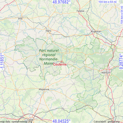
Couterne GPS coordinates[2]
48° 30' 47.448" North, 0° 24' 55.368" West
| Map corner | latitude | longitude |
|---|---|---|
| Upper-left | 48.97682°, | -1.11851° |
| Center: | 48.51318°, | -0.41538° |
| Lower-right: | 48.04525°, | 0.28774° |
| Map W x H: | 103.6×103.6 km | = 64.4×64.4mi |
| max Lat: | 51.07786° ⇑31.4% North |
| Couterne: | 48.51318° |
| min Lat: | ⇓68.6% South 41.3874° |
| min Long | Couterne | max Long |
| -5.08615° | -0.41538° | 9.52242° |
| W 17.7%⇐ | ⇒82.3% E |
Elevation
Elevation of Couterne is 133 m = 436 ft, and this is 60.7 m = 199 ft below average elevation for this country.
| Max E: |
2333 m = 7654 ft | 49.7% |
| Avg. | 193.7 m = 635 ft | |
| Couterne | 133 m = 436 ft | |
Min E: |
-1 m = -3 ft | 50.3% |
See also: France elevation on elevation.city.
Geographical zone
Couterne is located in North temperate zone (between Tropic of Cancer and the Arctic Circle). Distance of this North polar circle is 2007 km =1247.1 mi to North.| Distance of | km | miles | from Couterne |
|---|---|---|---|
| North Pole | 4612.9 | 2866.3 | to North |
| Arctic Circle | 2007 | 1247.1 | to North |
| Tropic Cancer | 2788.2 | 1732.5 | to South |
| Equator | 5394.2 | 3351.8 | to South |


Nearby cities:
15 places around Couterne: (largest is in red/bold)
• Bagnoles-de-l'Orne
4.9 km =3 mi,  1°
1°
• Ceaucé
15.6 km =9.7 mi,  262°
262°
• Champsecret
14.6 km =9.1 mi,  317°
317°
• Chantrigné
15.7 km =9.8 mi,  226°
226°
• Javron-les-Chapelles
12 km =7.5 mi,  151°
151°
• Juvigny-sous-Andaine
8.1 km =5 mi,  302°
302°
• La Coulonche
15.2 km =9.4 mi,  348°
348°
• La Ferté-Macé
9.5 km =5.9 mi,  26°
26°
• La Sauvagère
12.3 km =7.6 mi,  359°
359°
• Lassay-les-Châteaux
10.3 km =6.4 mi,  216°
216°
• Le Horps
13.3 km =8.3 mi,  194°
194°
• Lignières-Orgères
15.7 km =9.8 mi,  78°
78°
• Magny-le-Désert
9.1 km =5.7 mi,  45°
45°
• Saint-Maurice-du-Désert
11 km =6.8 mi,  10°
10°
• Tessé-la-Madeleine
4.1 km =2.5 mi, 349°
Sources, notices
• [Note1] Compared only with cities in France existing in our database
• [Src1] Map data: © OpenStreetMap contributors (CC-BY-SA)
• [Src2] Other city data from geonames.org with taken over terms of usage.
• [Src3] Geographical zone / Annual Mean Temperature by Robert A. Rohde @ Wikipedia
