Porcaro geodata
Porcaro (Brittany) is a populated place; located in France in Europe/Paris (GMT+2) time zone. With population of 542 people, there are 14349 cities with bigger population in this country. Compared to other cities in France, 57.7% of cities are located further ↓South; 95.5% of cities are located further →East and 75.8% of cities have higher elevation than Porcaro. Note1
Administrative division(s):
- Level 1: Brittany
- Level 2: Morbihan
- Level 3: Arrondissement de Vannes
- Level 4: Porcaro


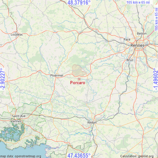
Porcaro GPS coordinates[2]
47° 54' 36" North, 2° 11' 56.904" West
| Map corner | latitude | longitude |
|---|---|---|
| Upper-left | 48.37916°, | -2.90227° |
| Center: | 47.91°, | -2.19914° |
| Lower-right: | 47.43655°, | -1.49602° |
| Map W x H: | 104.8×104.8 km | = 65.1×65.1mi |
| max Lat: | 51.07786° ⇑42.3% North |
| Porcaro: | 47.91° |
| min Lat: | ⇓57.7% South 41.3874° |
| min Long | Porcaro | max Long |
| -5.08615° | -2.19914° | 9.52242° |
| W 4.5%⇐ | ⇒95.5% E |
Elevation
Elevation of Porcaro is 65 m = 213 ft, and this is 128.7 m = 422 ft below average elevation for this country.
| Max E: |
2333 m = 7654 ft | 75.8% |
| Avg. | 193.7 m = 635 ft | |
| Porcaro | 65 m = 213 ft | |
Min E: |
-1 m = -3 ft | 24.2% |
See also: France elevation on elevation.city.
Geographical zone
Porcaro is located in North temperate zone (between Tropic of Cancer and the Arctic Circle). Distance of this North polar circle is 2074.1 km =1288.8 mi to North.| Distance of | km | miles | from Porcaro |
|---|---|---|---|
| North Pole | 4680 | 2908 | to North |
| Arctic Circle | 2074.1 | 1288.8 | to North |
| Tropic Cancer | 2721.2 | 1690.9 | to South |
| Equator | 5327.1 | 3310.1 | to South |


Nearby cities:
15 places around Porcaro: (largest is in red/bold)
• Augan
6 km =3.7 mi,  279°
279°
• Beignon
7.2 km =4.5 mi,  17°
17°
• Campénéac
8.7 km =5.4 mi,  307°
307°
• Carentoir
11.5 km =7.1 mi,  154°
154°
• Caro
10.3 km =6.4 mi,  240°
240°
• Comblessac
9.4 km =5.8 mi,  113°
113°
• Guer
5.7 km =3.5 mi,  94°
94°
• Missiriac
14 km =8.7 mi,  233°
233°
• Monteneuf
4.2 km =2.6 mi,  190°
190°
• Paimpont
12.2 km =7.6 mi,  9°
9°
• Plélan-le-Grand
12.6 km =7.8 mi,  36°
36°
• Quelneuc
13.8 km =8.6 mi,  133°
133°
• Ruffiac
11.9 km =7.4 mi,  211°
211°
• Saint-Malo-de-Beignon
6.6 km =4.1 mi, 35°
• Tréal
8.3 km =5.2 mi, 193°
Sources, notices
• [Note1] Compared only with cities in France existing in our database
• [Src1] Map data: © OpenStreetMap contributors (CC-BY-SA)
• [Src2] Other city data from geonames.org with taken over terms of usage.
• [Src3] Geographical zone / Annual Mean Temperature by Robert A. Rohde @ Wikipedia
