Pontgouin geodata
Pontgouin (Centre) is a populated place; located in France in Europe/Paris (GMT+2) time zone. With population of 997 people, there are 8849 cities with bigger population in this country. Compared to other cities in France, 67.9% of cities are located further ↓South; 67.2% of cities are located further →East and 63.1% of cities have lower elevation than Pontgouin. Note1
Administrative division(s):
- Level 1: Centre
- Level 2: Département d'Eure-et-Loir
- Level 3: Arrondissement de Chartres
- Level 4: Pontgouin


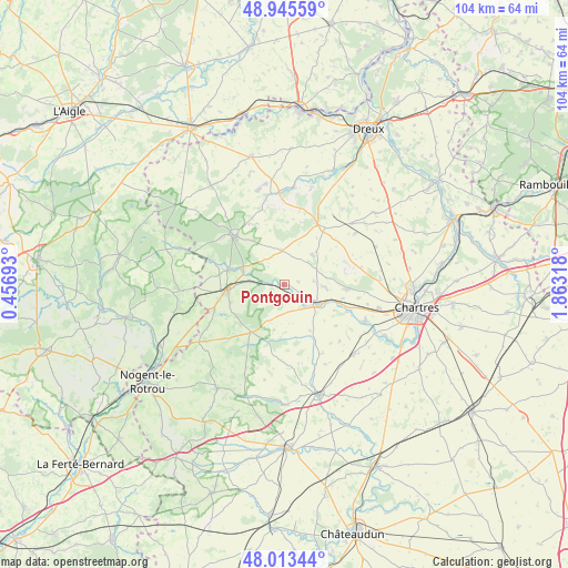
Pontgouin GPS coordinates[2]
48° 28' 53.976" North, 1° 9' 36.216" East
| Map corner | latitude | longitude |
|---|---|---|
| Upper-left | 48.94559°, | 0.45693° |
| Center: | 48.48166°, | 1.16006° |
| Lower-right: | 48.01344°, | 1.86318° |
| Map W x H: | 103.6×103.6 km | = 64.4×64.4mi |
| max Lat: | 51.07786° ⇑32.1% North |
| Pontgouin: | 48.48166° |
| min Lat: | ⇓67.9% South 41.3874° |
| min Long | Pontgouin | max Long |
| -5.08615° | 1.16006° | 9.52242° |
| W 32.8%⇐ | ⇒67.2% E |
Elevation
Elevation of Pontgouin is 185 m = 607 ft, and this is 8.7 m = 29 ft below average elevation for this country.
| Max E: |
2333 m = 7654 ft | 36.9% |
| Avg. | 193.7 m = 635 ft | |
| Pontgouin | 185 m = 607 ft | |
Min E: |
-1 m = -3 ft | 63.1% |
See also: France elevation on elevation.city.
Geographical zone
Pontgouin is located in North temperate zone (between Tropic of Cancer and the Arctic Circle). Distance of this North polar circle is 2010.5 km =1249.3 mi to North.| Distance of | km | miles | from Pontgouin |
|---|---|---|---|
| North Pole | 4616.4 | 2868.5 | to North |
| Arctic Circle | 2010.5 | 1249.3 | to North |
| Tropic Cancer | 2784.7 | 1730.3 | to South |
| Equator | 5390.7 | 3349.6 | to South |


Nearby cities:
15 places around Pontgouin: (largest is in red/bold)
• Belhomert-Guéhouville
7.9 km =4.9 mi,  289°
289°
• Chuisnes
5.2 km =3.2 mi,  138°
138°
• Châteauneuf-en-Thymerais
12.6 km =7.8 mi,  28°
28°
• Courville-sur-Eure
7 km =4.3 mi,  121°
121°
• Digny
6.1 km =3.8 mi,  355°
355°
• Fontaine-Simon
10.7 km =6.6 mi,  283°
283°
• Fontaine-la-Guyon
11.4 km =7.1 mi,  95°
95°
• Gâtelles
11.6 km =7.2 mi,  53°
53°
• La Loupe
10.7 km =6.6 mi,  264°
264°
• Landelles
3.2 km =2 mi, 119°
• Meaucé
11.6 km =7.2 mi,  272°
272°
• Saint-Arnoult-des-Bois
7.7 km =4.8 mi,  81°
81°
• Saint-Luperce
12.6 km =7.8 mi,  114°
114°
• Saint-Maurice-Saint-Germain
6.3 km =3.9 mi, 285°
• Saint-Éliph
10.5 km =6.5 mi,  250°
250°
Sources, notices
• [Note1] Compared only with cities in France existing in our database
• [Src1] Map data: © OpenStreetMap contributors (CC-BY-SA)
• [Src2] Other city data from geonames.org with taken over terms of usage.
• [Src3] Geographical zone / Annual Mean Temperature by Robert A. Rohde @ Wikipedia
