Chuisnes geodata
Chuisnes (Centre) is a populated place; located in France in Europe/Paris (GMT+2) time zone. With population of 848 people, there are 10102 cities with bigger population in this country. Compared to other cities in France, 67.2% of cities are located further ↓South; 66.7% of cities are located further →East and 59.8% of cities have lower elevation than Chuisnes. Note1
Administrative division(s):
- Level 1: Centre
- Level 2: Département d'Eure-et-Loir
- Level 3: Arrondissement de Chartres
- Level 4: Chuisnes


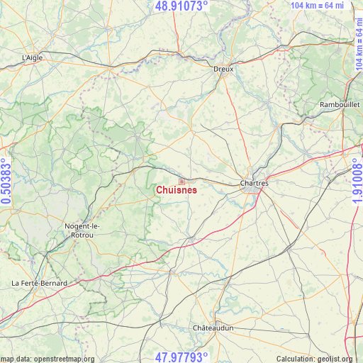
Chuisnes GPS coordinates[2]
48° 26' 47.292" North, 1° 12' 25.02" East
| Map corner | latitude | longitude |
|---|---|---|
| Upper-left | 48.91073°, | 0.50383° |
| Center: | 48.44647°, | 1.20695° |
| Lower-right: | 47.97793°, | 1.91008° |
| Map W x H: | 103.7×103.7 km | = 64.4×64.4mi |
| max Lat: | 51.07786° ⇑32.8% North |
| Chuisnes: | 48.44647° |
| min Lat: | ⇓67.2% South 41.3874° |
| min Long | Chuisnes | max Long |
| -5.08615° | 1.20695° | 9.52242° |
| W 33.3%⇐ | ⇒66.7% E |
Elevation
Elevation of Chuisnes is 169 m = 554 ft, and this is 24.7 m = 81 ft below average elevation for this country.
| Max E: |
2333 m = 7654 ft | 40.2% |
| Avg. | 193.7 m = 635 ft | |
| Chuisnes | 169 m = 554 ft | |
Min E: |
-1 m = -3 ft | 59.8% |
See also: France elevation on elevation.city.
Geographical zone
Chuisnes is located in North temperate zone (between Tropic of Cancer and the Arctic Circle). Distance of this North polar circle is 2014.4 km =1251.7 mi to North.| Distance of | km | miles | from Chuisnes |
|---|---|---|---|
| North Pole | 4620.3 | 2870.9 | to North |
| Arctic Circle | 2014.4 | 1251.7 | to North |
| Tropic Cancer | 2780.8 | 1727.9 | to South |
| Equator | 5386.7 | 3347.1 | to South |


Nearby cities:
15 places around Chuisnes: (largest is in red/bold)
• Bailleau-le-Pin
12.6 km =7.8 mi,  134°
134°
• Belhomert-Guéhouville
12.7 km =7.9 mi,  300°
300°
• Courville-sur-Eure
2.5 km =1.6 mi,  83°
83°
• Digny
10.7 km =6.6 mi,  338°
338°
• Fontaine-la-Guyon
8.4 km =5.2 mi,  69°
69°
• Gâtelles
12.3 km =7.6 mi,  28°
28°
• Landelles
2.4 km =1.5 mi, 343°
• Ollé
9.2 km =5.7 mi, 133°
• Pontgouin
5.2 km =3.2 mi,  318°
318°
• Saint-Arnoult-des-Bois
6.5 km =4 mi,  39°
39°
• Saint-Aubin-des-Bois
11.3 km =7 mi, 79°
• Saint-Georges-sur-Eure
11.3 km =7 mi,  105°
105°
• Saint-Luperce
8.1 km =5 mi,  98°
98°
• Saint-Maurice-Saint-Germain
11.1 km =6.9 mi, 300°
• Saint-Éliph
13.4 km =8.3 mi,  272°
272°
Sources, notices
• [Note1] Compared only with cities in France existing in our database
• [Src1] Map data: © OpenStreetMap contributors (CC-BY-SA)
• [Src2] Other city data from geonames.org with taken over terms of usage.
• [Src3] Geographical zone / Annual Mean Temperature by Robert A. Rohde @ Wikipedia
