Saint-Éliph geodata
Saint-Éliph (Centre) is a populated place; located in France in Europe/Paris (GMT+2) time zone. With population of 782 people, there are 10798 cities with bigger population in this country. Compared to other cities in France, 67.3% of cities are located further ↓South; 68.5% of cities are located further →East and 72.7% of cities have lower elevation than Saint-Éliph. Note1
Administrative division(s):
- Level 1: Centre
- Level 2: Département d'Eure-et-Loir
- Level 3: Arrondissement de Nogent-le-Rotrou
- Level 4: Saint-Éliph


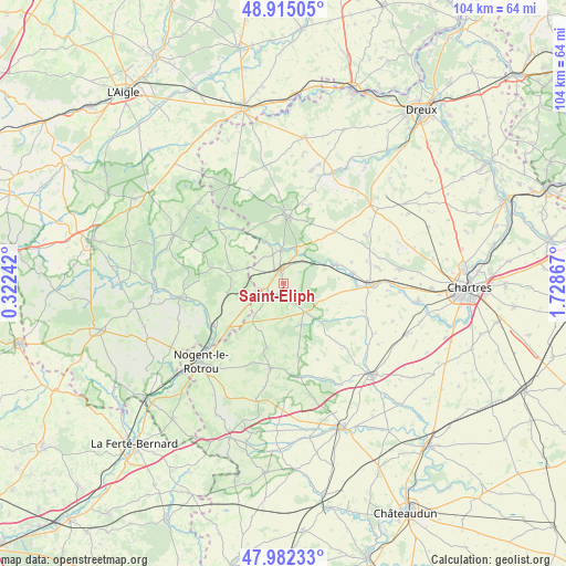
Saint-Éliph GPS coordinates[2]
48° 27' 2.988" North, 1° 1' 31.944" East
| Map corner | latitude | longitude |
|---|---|---|
| Upper-left | 48.91505°, | 0.32242° |
| Center: | 48.45083°, | 1.02554° |
| Lower-right: | 47.98233°, | 1.72867° |
| Map W x H: | 103.7×103.7 km | = 64.4×64.4mi |
| max Lat: | 51.07786° ⇑32.7% North |
| Saint-Éliph: | 48.45083° |
| min Lat: | ⇓67.3% South 41.3874° |
| min Long | Saint-Éliph | max Long |
| -5.08615° | 1.02554° | 9.52242° |
| W 31.5%⇐ | ⇒68.5% E |
Elevation
Elevation of Saint-Éliph is 234 m = 768 ft, and this is 40.3 m = 132 ft above average elevation for this country.
| Max E: |
2333 m = 7654 ft | 27.3% |
| Saint-Éliph | 234 m 768 ft | |
| Avg. | 193.7 m = 635 ft | |
Min E: |
-1 m = -3 ft | 72.7% |
See also: France elevation on elevation.city.
Geographical zone
Saint-Éliph is located in North temperate zone (between Tropic of Cancer and the Arctic Circle). Distance of this North polar circle is 2013.9 km =1251.4 mi to North.| Distance of | km | miles | from Saint-Éliph |
|---|---|---|---|
| North Pole | 4619.8 | 2870.6 | to North |
| Arctic Circle | 2013.9 | 1251.4 | to North |
| Tropic Cancer | 2781.3 | 1728.2 | to South |
| Equator | 5387.2 | 3347.4 | to South |


Nearby cities:
15 places around Saint-Éliph: (largest is in red/bold)
• Belhomert-Guéhouville
6.5 km =4 mi,  21°
21°
• Bretoncelles
10.4 km =6.5 mi,  257°
257°
• Chuisnes
13.4 km =8.3 mi,  92°
92°
• Condé-sur-Huisne
15 km =9.3 mi,  238°
238°
• Digny
13.4 km =8.3 mi,  44°
44°
• Fontaine-Simon
6 km =3.7 mi,  355°
355°
• La Loupe
2.6 km =1.6 mi,  343°
343°
• Landelles
12.8 km =8 mi,  81°
81°
• Manou
8.3 km =5.2 mi, 336°
• Meaucé
4.3 km =2.7 mi, 337°
• Moutiers-au-Perche
13.6 km =8.5 mi,  282°
282°
• Neuilly-sur-Eure
13.5 km =8.4 mi,  318°
318°
• Pontgouin
10.5 km =6.5 mi,  70°
70°
• Saint-Maurice-Saint-Germain
6.4 km =4 mi, 36°
• Senonches
12.1 km =7.5 mi,  1°
1°
Sources, notices
• [Note1] Compared only with cities in France existing in our database
• [Src1] Map data: © OpenStreetMap contributors (CC-BY-SA)
• [Src2] Other city data from geonames.org with taken over terms of usage.
• [Src3] Geographical zone / Annual Mean Temperature by Robert A. Rohde @ Wikipedia
