Plaudren geodata
Plaudren (Brittany) is a populated place; located in France in Europe/Paris (GMT+2) time zone. With population of 1,549 people, there are 6016 cities with bigger population in this country. Compared to other cities in France, 55.4% of cities are located further ↓South; 96.6% of cities are located further →East and 57.6% of cities have higher elevation than Plaudren. Note1
Administrative division(s):
- Level 1: Brittany
- Level 2: Morbihan
- Level 3: Arrondissement de Vannes
- Level 4: Plaudren


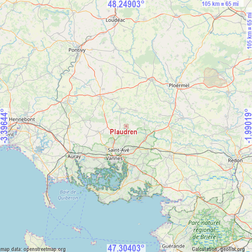
Plaudren GPS coordinates[2]
47° 46' 43.248" North, 2° 41' 35.916" West
| Map corner | latitude | longitude |
|---|---|---|
| Upper-left | 48.24903°, | -3.39644° |
| Center: | 47.77868°, | -2.69331° |
| Lower-right: | 47.30403°, | -1.99019° |
| Map W x H: | 105.1×105.1 km | = 65.3×65.3mi |
| max Lat: | 51.07786° ⇑44.6% North |
| Plaudren: | 47.77868° |
| min Lat: | ⇓55.4% South 41.3874° |
| min Long | Plaudren | max Long |
| -5.08615° | -2.69331° | 9.52242° |
| W 3.4%⇐ | ⇒96.6% E |
Elevation
Elevation of Plaudren is 109 m = 358 ft, and this is 84.7 m = 278 ft below average elevation for this country.
| Max E: |
2333 m = 7654 ft | 57.6% |
| Avg. | 193.7 m = 635 ft | |
| Plaudren | 109 m = 358 ft | |
Min E: |
-1 m = -3 ft | 42.4% |
See also: France elevation on elevation.city.
Geographical zone
Plaudren is located in North temperate zone (between Tropic of Cancer and the Arctic Circle). Distance of this North polar circle is 2088.7 km =1297.9 mi to North.| Distance of | km | miles | from Plaudren |
|---|---|---|---|
| North Pole | 4694.6 | 2917.1 | to North |
| Arctic Circle | 2088.7 | 1297.9 | to North |
| Tropic Cancer | 2706.6 | 1681.8 | to South |
| Equator | 5312.5 | 3301 | to South |


Nearby cities:
15 places around Plaudren: (largest is in red/bold)
• Bignan
12.6 km =7.8 mi,  332°
332°
• Colpo
9.7 km =6 mi,  296°
296°
• Elven
9.3 km =5.8 mi,  123°
123°
• Grand-Champ
11.7 km =7.3 mi,  258°
258°
• Guéhenno
13.2 km =8.2 mi,  17°
17°
• Locmaria-Grand-Champ
7.4 km =4.6 mi,  250°
250°
• Meucon
8.6 km =5.3 mi,  216°
216°
• Monterblanc
4.2 km =2.6 mi,  165°
165°
• Plescop
12.3 km =7.6 mi, 222°
• Plumelec
7.7 km =4.8 mi,  31°
31°
• Saint-Avé
10.5 km =6.5 mi,  202°
202°
• Saint-Jean-Brévelay
7.7 km =4.8 mi,  343°
343°
• Saint-Nolff
8.9 km =5.5 mi,  159°
159°
• Treffléan
12.4 km =7.7 mi,  150°
150°
• Trédion
7.7 km =4.8 mi,  79°
79°
Sources, notices
• [Note1] Compared only with cities in France existing in our database
• [Src1] Map data: © OpenStreetMap contributors (CC-BY-SA)
• [Src2] Other city data from geonames.org with taken over terms of usage.
• [Src3] Geographical zone / Annual Mean Temperature by Robert A. Rohde @ Wikipedia
