Locmaria-Grand-Champ geodata
Locmaria-Grand-Champ (Brittany) is a populated place; located in France in Europe/Paris (GMT+2) time zone. With population of 945 people, there are 9241 cities with bigger population in this country. Compared to other cities in France, 55.1% of cities are located further ↓South; 96.8% of cities are located further →East and 68.3% of cities have higher elevation than Locmaria-Grand-Champ. Note1
Administrative division(s):
- Level 1: Brittany
- Level 2: Morbihan
- Level 3: Arrondissement de Vannes
- Level 4: Locmaria-Grand-Champ
Current local time in Locmaria-Grand-Champ:
06:01 AM, WednesdayDifference from your time zone: hours


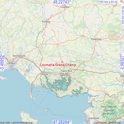
Locmaria-Grand-Champ GPS coordinates[2]
47° 45' 24.768" North, 2° 47' 11.004" West
| Map corner | latitude | longitude |
|---|---|---|
| Upper-left | 48.22743°, | -3.48952° |
| Center: | 47.75688°, | -2.78639° |
| Lower-right: | 47.28204°, | -2.08327° |
| Map W x H: | 105.1×105.1 km | = 65.3×65.3mi |
| max Lat: | 51.07786° ⇑44.9% North |
| Locmaria-Grand-Champ: | 47.75688° |
| min Lat: | ⇓55.1% South 41.3874° |
| min Long | Locmaria-Grand- | max Long |
| -5.08615° | -2.78639° | 9.52242° |
| W 3.2%⇐ | ⇒96.8% E |
Elevation
Elevation of Locmaria-Grand-Champ is 82 m = 269 ft, and this is 111.7 m = 366 ft below average elevation for this country.
| Max E: |
2333 m = 7654 ft | 68.3% |
| Avg. | 193.7 m = 635 ft | |
| Locmaria-Grand-Champ | 82 m = 269 ft | |
Min E: |
-1 m = -3 ft | 31.7% |
See also: France elevation on elevation.city.
Geographical zone
Locmaria-Grand-Champ is located in North temperate zone (between Tropic of Cancer and the Arctic Circle). Distance of this North polar circle is 2091.1 km =1299.3 mi to North.| Distance of | km | miles | from Locmaria-Grand-Champ |
|---|---|---|---|
| North Pole | 4697 | 2918.6 | to North |
| Arctic Circle | 2091.1 | 1299.3 | to North |
| Tropic Cancer | 2704.1 | 1680.2 | to South |
| Equator | 5310.1 | 3299.5 | to South |


Nearby cities:
15 places around Locmaria-Grand-Champ: (largest is in red/bold)
• Bignan
13.7 km =8.5 mi,  4°
4°
• Brandivy
12 km =7.5 mi,  278°
278°
• Colpo
7 km =4.3 mi,  345°
345°
• Grand-Champ
4.5 km =2.8 mi,  271°
271°
• Meucon
4.9 km =3 mi,  157°
157°
• Monterblanc
8.2 km =5.1 mi,  101°
101°
• Moustoir-Ac
11.5 km =7.1 mi,  341°
341°
• Plaudren
7.4 km =4.6 mi,  70°
70°
• Plescop
6.8 km =4.2 mi,  192°
192°
• Ploeren
12.5 km =7.8 mi,  207°
207°
• Plumergat
9.8 km =6.1 mi,  259°
259°
• Saint-Avé
7.9 km =4.9 mi, 157°
• Saint-Jean-Brévelay
10.9 km =6.8 mi,  26°
26°
• Saint-Nolff
11.7 km =7.3 mi,  120°
120°
• Vannes
11.2 km =7 mi,  168°
168°
Sources, notices
• [Note1] Compared only with cities in France existing in our database
• [Src1] Map data: © OpenStreetMap contributors (CC-BY-SA)
• [Src2] Other city data from geonames.org with taken over terms of usage.
• [Src3] Geographical zone / Annual Mean Temperature by Robert A. Rohde @ Wikipedia
