Cavanac geodata
Cavanac (Occitanie) is a populated place; located in France in Europe/Paris (GMT+2) time zone. With population of 796 people, there are 10658 cities with bigger population in this country. Compared to other cities in France, 97.5% of cities are located further ↑North; 52.2% of cities are located further →East and 57.6% of cities have lower elevation than Cavanac. Note1
Administrative division(s):
- Level 1: Occitanie
- Level 2: Département de l'Aude
- Level 3: Arrondissement de Carcassonne
- Level 4: Cavanac


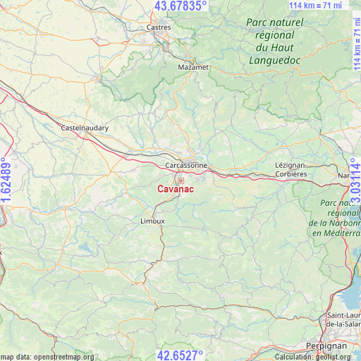
Cavanac GPS coordinates[2]
43° 10' 3.648" North, 2° 19' 40.836" East
| Map corner | latitude | longitude |
|---|---|---|
| Upper-left | 43.67835°, | 1.62489° |
| Center: | 43.16768°, | 2.32801° |
| Lower-right: | 42.6527°, | 3.03114° |
| Map W x H: | 114×114 km | = 70.8×70.8mi |
| max Lat: | 51.07786° ⇑97.5% North |
| Cavanac: | 43.16768° |
| min Lat: | ⇓2.5% South 41.3874° |
| min Long | Cavanac | max Long |
| -5.08615° | 2.32801° | 9.52242° |
| W 47.8%⇐ | ⇒52.2% E |
Elevation
Elevation of Cavanac is 160 m = 525 ft, and this is 33.7 m = 111 ft below average elevation for this country.
| Max E: |
2333 m = 7654 ft | 42.4% |
| Avg. | 193.7 m = 635 ft | |
| Cavanac | 160 m = 525 ft | |
Min E: |
-1 m = -3 ft | 57.6% |
See also: France elevation on elevation.city.
Geographical zone
Cavanac is located in North temperate zone (between Tropic of Cancer and the Arctic Circle). Distance of this Northern Tropic circle is 2193.9 km =1363.2 mi to South.| Distance of | km | miles | from Cavanac |
|---|---|---|---|
| North Pole | 5207.3 | 3235.7 | to North |
| Arctic Circle | 2601.4 | 1616.4 | to North |
| Tropic Cancer | 2193.9 | 1363.2 | to South |
| Equator | 4799.8 | 2982.5 | to South |


Nearby cities:
15 places around Cavanac: (largest is in red/bold)
• Alairac
7.3 km =4.5 mi,  285°
285°
• Arzens
10.2 km =6.3 mi, 289°
• Berriac
8.4 km =5.2 mi,  53°
53°
• Carcassonne
5.4 km =3.4 mi,  20°
20°
• Caux-et-Sauzens
8.7 km =5.4 mi,  317°
317°
• Cazilhac
3.1 km =1.9 mi,  59°
59°
• Couffoulens
2.2 km =1.4 mi,  231°
231°
• Cépie
9.7 km =6 mi,  223°
223°
• Lavalette
5.2 km =3.2 mi, 290°
• Leuc
2.3 km =1.4 mi,  189°
189°
• Palaja
4.6 km =2.9 mi,  81°
81°
• Pennautier
8.6 km =5.3 mi,  355°
355°
• Pomas
6.8 km =4.2 mi,  204°
204°
• Saint-Hilaire
8.5 km =5.3 mi, 189°
• Villemoustaussou
9.8 km =6.1 mi, 17°
Sources, notices
• [Note1] Compared only with cities in France existing in our database
• [Src1] Map data: © OpenStreetMap contributors (CC-BY-SA)
• [Src2] Other city data from geonames.org with taken over terms of usage.
• [Src3] Geographical zone / Annual Mean Temperature by Robert A. Rohde @ Wikipedia
