Saint-Hilaire geodata
Saint-Hilaire (Occitanie) is a populated place; located in France in Europe/Paris (GMT+2) time zone. With population of 758 people, there are 11078 cities with bigger population in this country. Compared to other cities in France, 98% of cities are located further ↑North; 52.5% of cities are located further →East and 59.3% of cities have lower elevation than Saint-Hilaire. Note1
Administrative division(s):
- Level 1: Occitanie
- Level 2: Département de l'Aude
- Level 3: Arrondissement de Limoux
- Level 4: Saint-Hilaire


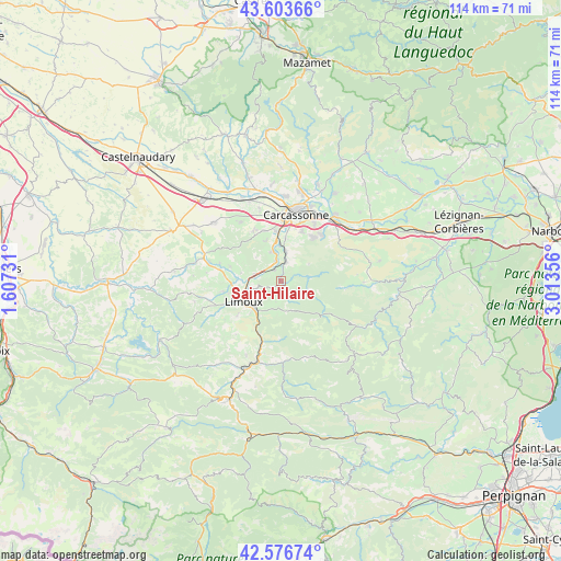
Saint-Hilaire GPS coordinates[2]
43° 5' 32.46" North, 2° 18' 37.584" East
| Map corner | latitude | longitude |
|---|---|---|
| Upper-left | 43.60366°, | 1.60731° |
| Center: | 43.09235°, | 2.31044° |
| Lower-right: | 42.57674°, | 3.01356° |
| Map W x H: | 114.2×114.2 km | = 71×71mi |
| max Lat: | 51.07786° ⇑98% North |
| Saint-Hilaire: | 43.09235° |
| min Lat: | ⇓2% South 41.3874° |
| min Long | Saint-Hilaire | max Long |
| -5.08615° | 2.31044° | 9.52242° |
| W 47.5%⇐ | ⇒52.5% E |
Elevation
Elevation of Saint-Hilaire is 167 m = 548 ft, and this is 26.7 m = 88 ft below average elevation for this country.
| Max E: |
2333 m = 7654 ft | 40.7% |
| Avg. | 193.7 m = 635 ft | |
| Saint-Hilaire | 167 m = 548 ft | |
Min E: |
-1 m = -3 ft | 59.3% |
See also: France elevation on elevation.city.
Geographical zone
Saint-Hilaire is located in North temperate zone (between Tropic of Cancer and the Arctic Circle). Distance of this Northern Tropic circle is 2185.5 km =1358 mi to South.| Distance of | km | miles | from Saint-Hilaire |
|---|---|---|---|
| North Pole | 5215.6 | 3240.8 | to North |
| Arctic Circle | 2609.8 | 1621.7 | to North |
| Tropic Cancer | 2185.5 | 1358 | to South |
| Equator | 4791.4 | 2977.2 | to South |


Nearby cities:
15 places around Saint-Hilaire: (largest is in red/bold)
• Alairac
11.7 km =7.3 mi,  331°
331°
• Alet-les-Bains
11.7 km =7.3 mi,  202°
202°
• Arzens
14.4 km =8.9 mi, 325°
• Carcassonne
13.9 km =8.6 mi,  13°
13°
• Cavanac
8.5 km =5.3 mi, 9°
• Cazilhac
10.8 km =6.7 mi,  22°
22°
• Couffoulens
7 km =4.3 mi,  357°
357°
• Cournanel
9.1 km =5.7 mi,  223°
223°
• Cépie
5.5 km =3.4 mi,  284°
284°
• Lavalette
10.8 km =6.7 mi,  341°
341°
• Leuc
6.2 km =3.9 mi, 9°
• Limoux
8.3 km =5.2 mi,  239°
239°
• Palaja
10.9 km =6.8 mi,  33°
33°
• Pieusse
6.5 km =4 mi,  257°
257°
• Pomas
2.6 km =1.6 mi, 326°
Sources, notices
• [Note1] Compared only with cities in France existing in our database
• [Src1] Map data: © OpenStreetMap contributors (CC-BY-SA)
• [Src2] Other city data from geonames.org with taken over terms of usage.
• [Src3] Geographical zone / Annual Mean Temperature by Robert A. Rohde @ Wikipedia
