Couffoulens geodata
Couffoulens (Occitanie) is a populated place; located in France in Europe/Paris (GMT+2) time zone. With population of 582 people, there are 13612 cities with bigger population in this country. Compared to other cities in France, 97.6% of cities are located further ↑North; 52.6% of cities are located further →East and 53.9% of cities have lower elevation than Couffoulens. Note1
Administrative division(s):
- Level 1: Occitanie
- Level 2: Département de l'Aude
- Level 3: Arrondissement de Carcassonne
- Level 4: Couffoulens


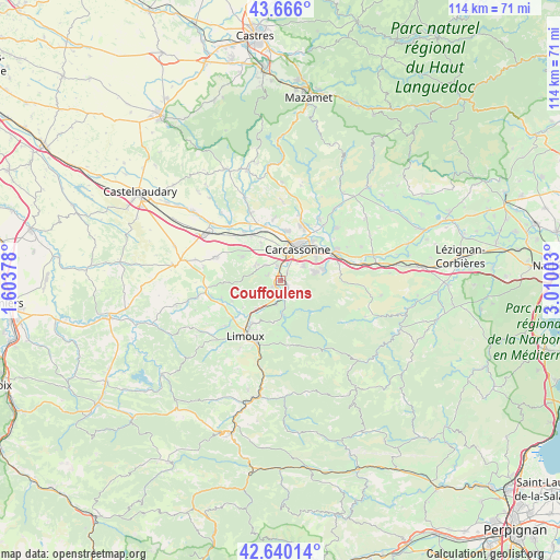
Couffoulens GPS coordinates[2]
43° 9' 18.792" North, 2° 18' 24.876" East
| Map corner | latitude | longitude |
|---|---|---|
| Upper-left | 43.666°, | 1.60378° |
| Center: | 43.15522°, | 2.30691° |
| Lower-right: | 42.64014°, | 3.01003° |
| Map W x H: | 114.1×114.1 km | = 70.9×70.9mi |
| max Lat: | 51.07786° ⇑97.6% North |
| Couffoulens: | 43.15522° |
| min Lat: | ⇓2.4% South 41.3874° |
| min Long | Couffoulens | max Long |
| -5.08615° | 2.30691° | 9.52242° |
| W 47.4%⇐ | ⇒52.6% E |
Elevation
Elevation of Couffoulens is 146 m = 479 ft, and this is 47.7 m = 156 ft below average elevation for this country.
| Max E: |
2333 m = 7654 ft | 46.1% |
| Avg. | 193.7 m = 635 ft | |
| Couffoulens | 146 m = 479 ft | |
Min E: |
-1 m = -3 ft | 53.9% |
See also: France elevation on elevation.city.
Geographical zone
Couffoulens is located in North temperate zone (between Tropic of Cancer and the Arctic Circle). Distance of this Northern Tropic circle is 2192.5 km =1362.4 mi to South.| Distance of | km | miles | from Couffoulens |
|---|---|---|---|
| North Pole | 5208.7 | 3236.5 | to North |
| Arctic Circle | 2602.8 | 1617.3 | to North |
| Tropic Cancer | 2192.5 | 1362.4 | to South |
| Equator | 4798.4 | 2981.6 | to South |


Nearby cities:
15 places around Couffoulens: (largest is in red/bold)
• Alairac
6.3 km =3.9 mi,  301°
301°
• Arzens
9.2 km =5.7 mi, 301°
• Carcassonne
7.4 km =4.6 mi,  29°
29°
• Caux-et-Sauzens
8.8 km =5.5 mi,  332°
332°
• Cavanac
2.2 km =1.4 mi,  51°
51°
• Cazilhac
5.3 km =3.3 mi,  55°
55°
• Cépie
7.5 km =4.7 mi,  221°
221°
• Lavalette
4.5 km =2.8 mi,  315°
315°
• Leuc
1.6 km =1 mi,  123°
123°
• Palaja
6.6 km =4.1 mi,  72°
72°
• Pennautier
10 km =6.2 mi,  5°
5°
• Pieusse
10.3 km =6.4 mi, 215°
• Pomas
4.9 km =3 mi,  193°
193°
• Saint-Hilaire
7 km =4.3 mi,  177°
177°
• Villesèquelande
10.5 km =6.5 mi, 325°
Sources, notices
• [Note1] Compared only with cities in France existing in our database
• [Src1] Map data: © OpenStreetMap contributors (CC-BY-SA)
• [Src2] Other city data from geonames.org with taken over terms of usage.
• [Src3] Geographical zone / Annual Mean Temperature by Robert A. Rohde @ Wikipedia
