Stiring-Wendel geodata
Stiring-Wendel (Grand Est) is a populated place; located in France in Europe/Paris (GMT+2) time zone. With population of 13,085 people, there are 729 cities with bigger population in this country. Compared to other cities in France, 84.3% of cities are located further ↓South; 94.4% of cities are located further ←West and 70.4% of cities have lower elevation than Stiring-Wendel. Note1
Administrative division(s):
- Level 1: Grand Est
- Level 2: Moselle
- Level 3: Arrondissement de Forbach-Boulay-Moselle
- Level 4: Stiring-Wendel


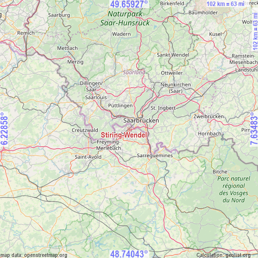
Stiring-Wendel GPS coordinates[2]
49° 12' 7.128" North, 6° 55' 54.12" East
| Map corner | latitude | longitude |
|---|---|---|
| Upper-left | 49.65927°, | 6.22858° |
| Center: | 49.20198°, | 6.9317° |
| Lower-right: | 48.74043°, | 7.63483° |
| Map W x H: | 102.2×102.2 km | = 63.5×63.5mi |
| max Lat: | 51.07786° ⇑15.7% North |
| Stiring-Wendel: | 49.20198° |
| min Lat: | ⇓84.3% South 41.3874° |
| min Long | Stiring-Wendel | max Long |
| -5.08615° | 6.9317° | 9.52242° |
| W 94.4%⇐ | ⇒5.6% E |
Elevation
Elevation of Stiring-Wendel is 221 m = 725 ft, and this is 27.3 m = 90 ft above average elevation for this country.
| Max E: |
2333 m = 7654 ft | 29.6% |
| Stiring-Wendel | 221 m 725 ft | |
| Avg. | 193.7 m = 635 ft | |
Min E: |
-1 m = -3 ft | 70.4% |
See also: France elevation on elevation.city.
Geographical zone
Stiring-Wendel is located in North temperate zone (between Tropic of Cancer and the Arctic Circle). Distance of this North polar circle is 1930.4 km =1199.5 mi to North.| Distance of | km | miles | from Stiring-Wendel |
|---|---|---|---|
| North Pole | 4536.3 | 2818.7 | to North |
| Arctic Circle | 1930.4 | 1199.5 | to North |
| Tropic Cancer | 2864.8 | 1780.1 | to South |
| Equator | 5470.7 | 3399.3 | to South |


Nearby cities:
15 places around Stiring-Wendel: (largest is in red/bold)
• Alsting
5 km =3.1 mi,  116°
116°
• Behren-lès-Forbach
3.7 km =2.3 mi,  171°
171°
• Bousbach
6 km =3.7 mi, 167°
• Etzling
3.2 km =2 mi,  142°
142°
• Folkling
6.6 km =4.1 mi,  203°
203°
• Forbach
3.2 km =2 mi,  242°
242°
• Grosbliederstroff
8.3 km =5.2 mi,  126°
126°
• Kerbach
4.6 km =2.9 mi,  147°
147°
• Lixing-lès-Rouhling
7 km =4.3 mi, 140°
• Morsbach
5.8 km =3.6 mi,  229°
229°
• Petite-Rosselle
5.6 km =3.5 mi,  281°
281°
• Rosbruck
7.6 km =4.7 mi, 230°
• Schœneck
2 km =1.2 mi,  326°
326°
• Spicheren
2.7 km =1.7 mi,  112°
112°
• Œting
3.5 km =2.2 mi, 200°
Sources, notices
• [Note1] Compared only with cities in France existing in our database
• [Src1] Map data: © OpenStreetMap contributors (CC-BY-SA)
• [Src2] Other city data from geonames.org with taken over terms of usage.
• [Src3] Geographical zone / Annual Mean Temperature by Robert A. Rohde @ Wikipedia
