Pabu geodata
Pabu (Brittany) is a populated place; located in France in Europe/Paris (GMT+2) time zone. With population of 2,829 people, there are 3445 cities with bigger population in this country. Compared to other cities in France, 70.5% of cities are located further ↓South; 97.6% of cities are located further →East and 56.5% of cities have higher elevation than Pabu. Note1
Administrative division(s):
- Level 1: Brittany
- Level 2: Département des Côtes-d’Armor
- Level 3: Arrondissement de Guingamp
- Level 4: Pabu


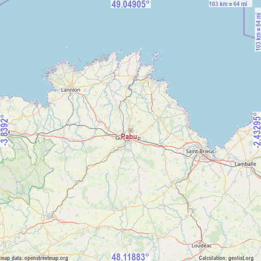
Pabu GPS coordinates[2]
48° 35' 9.888" North, 3° 8' 9.888" West
| Map corner | latitude | longitude |
|---|---|---|
| Upper-left | 49.04905°, | -3.8392° |
| Center: | 48.58608°, | -3.13608° |
| Lower-right: | 48.11883°, | -2.43295° |
| Map W x H: | 103.4×103.4 km | = 64.2×64.2mi |
| max Lat: | 51.07786° ⇑29.5% North |
| Pabu: | 48.58608° |
| min Lat: | ⇓70.5% South 41.3874° |
| min Long | Pabu | max Long |
| -5.08615° | -3.13608° | 9.52242° |
| W 2.4%⇐ | ⇒97.6% E |
Elevation
Elevation of Pabu is 112 m = 367 ft, and this is 81.7 m = 268 ft below average elevation for this country.
| Max E: |
2333 m = 7654 ft | 56.5% |
| Avg. | 193.7 m = 635 ft | |
| Pabu | 112 m = 367 ft | |
Min E: |
-1 m = -3 ft | 43.5% |
See also: France elevation on elevation.city.
Geographical zone
Pabu is located in North temperate zone (between Tropic of Cancer and the Arctic Circle). Distance of this North polar circle is 1998.9 km =1242.1 mi to North.| Distance of | km | miles | from Pabu |
|---|---|---|---|
| North Pole | 4604.8 | 2861.3 | to North |
| Arctic Circle | 1998.9 | 1242.1 | to North |
| Tropic Cancer | 2796.3 | 1737.5 | to South |
| Equator | 5402.3 | 3356.8 | to South |


Nearby cities:
15 places around Pabu: (largest is in red/bold)
• Coadout
8.5 km =5.3 mi,  206°
206°
• Goudelin
8.9 km =5.5 mi,  77°
77°
• Grâces
4.9 km =3 mi,  227°
227°
• Guingamp
2.8 km =1.7 mi,  202°
202°
• Lanrodec
11 km =6.8 mi,  135°
135°
• Le Merzer
5.2 km =3.2 mi,  103°
103°
• Moustéru
10.8 km =6.7 mi,  224°
224°
• Plouisy
3.7 km =2.3 mi,  256°
256°
• Ploumagoar
4.6 km =2.9 mi,  176°
176°
• Pommerit-le-Vicomte
5.1 km =3.2 mi,  42°
42°
• Pédernec
9.9 km =6.2 mi,  276°
276°
• Saint-Agathon
3.8 km =2.4 mi, 143°
• Saint-Clet
8.8 km =5.5 mi,  1°
1°
• Squiffiec
4.9 km =3 mi,  344°
344°
• Tréglamus
10.7 km =6.6 mi,  252°
252°
Sources, notices
• [Note1] Compared only with cities in France existing in our database
• [Src1] Map data: © OpenStreetMap contributors (CC-BY-SA)
• [Src2] Other city data from geonames.org with taken over terms of usage.
• [Src3] Geographical zone / Annual Mean Temperature by Robert A. Rohde @ Wikipedia
