Pavilly geodata
Pavilly (Normandy) is a populated place; located in France in Europe/Paris (GMT+2) time zone. With population of 6,251 people, there are 1588 cities with bigger population in this country. Compared to other cities in France, 90.2% of cities are located further ↓South; 69.2% of cities are located further →East and 79.4% of cities have higher elevation than Pavilly. Note1
Administrative division(s):
- Level 1: Normandy
- Level 2: Seine-Maritime
- Level 3: Arrondissement de Rouen
- Level 4: Pavilly


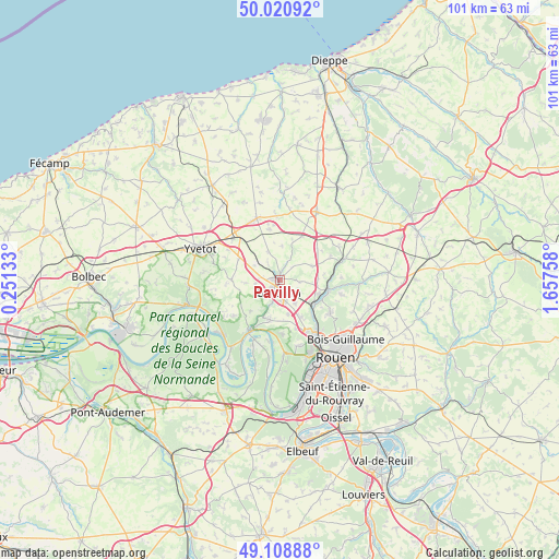
Pavilly GPS coordinates[2]
49° 34' 1.308" North, 0° 57' 16.02" East
| Map corner | latitude | longitude |
|---|---|---|
| Upper-left | 50.02092°, | 0.25133° |
| Center: | 49.56703°, | 0.95445° |
| Lower-right: | 49.10888°, | 1.65758° |
| Map W x H: | 101.4×101.4 km | = 63×63mi |
| max Lat: | 51.07786° ⇑9.8% North |
| Pavilly: | 49.56703° |
| min Lat: | ⇓90.2% South 41.3874° |
| min Long | Pavilly | max Long |
| -5.08615° | 0.95445° | 9.52242° |
| W 30.8%⇐ | ⇒69.2% E |
Elevation
Elevation of Pavilly is 56 m = 184 ft, and this is 137.7 m = 452 ft below average elevation for this country.
| Max E: |
2333 m = 7654 ft | 79.4% |
| Avg. | 193.7 m = 635 ft | |
| Pavilly | 56 m = 184 ft | |
Min E: |
-1 m = -3 ft | 20.6% |
See also: France elevation on elevation.city.
Geographical zone
Pavilly is located in North temperate zone (between Tropic of Cancer and the Arctic Circle). Distance of this North polar circle is 1889.8 km =1174.3 mi to North.| Distance of | km | miles | from Pavilly |
|---|---|---|---|
| North Pole | 4495.7 | 2793.5 | to North |
| Arctic Circle | 1889.8 | 1174.3 | to North |
| Tropic Cancer | 2905.4 | 1805.3 | to South |
| Equator | 5511.3 | 3424.6 | to South |


Nearby cities:
15 places around Pavilly: (largest is in red/bold)
• Anceaumeville
7 km =4.3 mi,  85°
85°
• Barentin
2.4 km =1.5 mi,  178°
178°
• Blacqueville
6.3 km =3.9 mi,  264°
264°
• Bouville
4.3 km =2.7 mi, 262°
• Eslettes
7.6 km =4.7 mi,  106°
106°
• Limésy
5.5 km =3.4 mi,  337°
337°
• Malaunay
7.8 km =4.8 mi,  124°
124°
• Mesnil-Panneville
5.2 km =3.2 mi,  299°
299°
• Pissy-Pôville
5 km =3.1 mi,  146°
146°
• Roumare
6.5 km =4 mi,  167°
167°
• Saint-Pierre-de-Varengeville
7.4 km =4.6 mi,  193°
193°
• Sainte-Austreberthe
3.7 km =2.3 mi,  24°
24°
• Sierville
6.3 km =3.9 mi,  66°
66°
• Villers-Écalles
3.8 km =2.4 mi,  221°
221°
• Émanville
6.2 km =3.9 mi,  3°
3°
Sources, notices
• [Note1] Compared only with cities in France existing in our database
• [Src1] Map data: © OpenStreetMap contributors (CC-BY-SA)
• [Src2] Other city data from geonames.org with taken over terms of usage.
• [Src3] Geographical zone / Annual Mean Temperature by Robert A. Rohde @ Wikipedia
