Barentin geodata
Barentin (Normandy) is a populated place; located in France in Europe/Paris (GMT+2) time zone. With population of 13,441 people, there are 710 cities with bigger population in this country. Compared to other cities in France, 89.9% of cities are located further ↓South; 69.2% of cities are located further →East and 84.1% of cities have higher elevation than Barentin. Note1
Administrative division(s):
- Level 1: Normandy
- Level 2: Seine-Maritime
- Level 3: Arrondissement de Rouen
- Level 4: Barentin


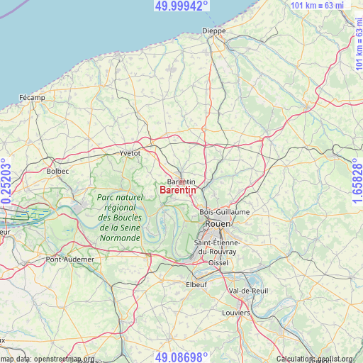
Barentin GPS coordinates[2]
49° 32' 43.188" North, 0° 57' 18.54" East
| Map corner | latitude | longitude |
|---|---|---|
| Upper-left | 49.99942°, | 0.25203° |
| Center: | 49.54533°, | 0.95515° |
| Lower-right: | 49.08698°, | 1.65828° |
| Map W x H: | 101.5×101.5 km | = 63.1×63.1mi |
| max Lat: | 51.07786° ⇑10.1% North |
| Barentin: | 49.54533° |
| min Lat: | ⇓89.9% South 41.3874° |
| min Long | Barentin | max Long |
| -5.08615° | 0.95515° | 9.52242° |
| W 30.8%⇐ | ⇒69.2% E |
Elevation
Elevation of Barentin is 44 m = 144 ft, and this is 149.7 m = 491 ft below average elevation for this country.
| Max E: |
2333 m = 7654 ft | 84.1% |
| Avg. | 193.7 m = 635 ft | |
| Barentin | 44 m = 144 ft | |
Min E: |
-1 m = -3 ft | 15.9% |
See also: France elevation on elevation.city.
Geographical zone
Barentin is located in North temperate zone (between Tropic of Cancer and the Arctic Circle). Distance of this North polar circle is 1892.2 km =1175.8 mi to North.| Distance of | km | miles | from Barentin |
|---|---|---|---|
| North Pole | 4498.1 | 2795 | to North |
| Arctic Circle | 1892.2 | 1175.8 | to North |
| Tropic Cancer | 2903 | 1803.8 | to South |
| Equator | 5508.9 | 3423.1 | to South |


Nearby cities:
15 places around Barentin: (largest is in red/bold)
• Blacqueville
6.6 km =4.1 mi,  286°
286°
• Bouville
4.7 km =2.9 mi, 293°
• Eslettes
7.2 km =4.5 mi,  87°
87°
• La Vaupalière
7 km =4.3 mi,  155°
155°
• Le Houlme
7 km =4.3 mi,  124°
124°
• Malaunay
6.6 km =4.1 mi,  107°
107°
• Mesnil-Panneville
6.7 km =4.2 mi,  317°
317°
• Pavilly
2.4 km =1.5 mi,  358°
358°
• Pissy-Pôville
3.2 km =2 mi, 122°
• Roumare
4.2 km =2.6 mi, 160°
• Saint-Jean-du-Cardonnay
6.1 km =3.8 mi,  138°
138°
• Saint-Paër
6.5 km =4 mi,  237°
237°
• Saint-Pierre-de-Varengeville
5.1 km =3.2 mi,  199°
199°
• Sainte-Austreberthe
6 km =3.7 mi,  14°
14°
• Villers-Écalles
2.6 km =1.6 mi,  260°
260°
Sources, notices
• [Note1] Compared only with cities in France existing in our database
• [Src1] Map data: © OpenStreetMap contributors (CC-BY-SA)
• [Src2] Other city data from geonames.org with taken over terms of usage.
• [Src3] Geographical zone / Annual Mean Temperature by Robert A. Rohde @ Wikipedia
