Paule geodata
Paule (Brittany) is a populated place; located in France in Europe/Paris (GMT+2) time zone. With population of 682 people, there are 12047 cities with bigger population in this country. Compared to other cities in France, 63.4% of cities are located further ↓South; 98.2% of cities are located further →East and 61% of cities have lower elevation than Paule. Note1
Administrative division(s):
- Level 1: Brittany
- Level 2: Département des Côtes-d’Armor
- Level 3: Arrondissement de Guingamp
- Level 4: Paule


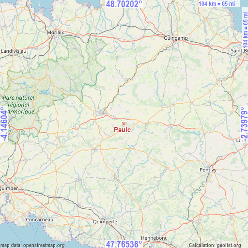
Paule GPS coordinates[2]
48° 14' 8.988" North, 3° 26' 34.512" West
| Map corner | latitude | longitude |
|---|---|---|
| Upper-left | 48.70202°, | -4.14604° |
| Center: | 48.23583°, | -3.44292° |
| Lower-right: | 47.76536°, | -2.73979° |
| Map W x H: | 104.1×104.1 km | = 64.7×64.7mi |
| max Lat: | 51.07786° ⇑36.6% North |
| Paule: | 48.23583° |
| min Lat: | ⇓63.4% South 41.3874° |
| min Long | Paule | max Long |
| -5.08615° | -3.44292° | 9.52242° |
| W 1.8%⇐ | ⇒98.2% E |
Elevation
Elevation of Paule is 175 m = 574 ft, and this is 18.7 m = 61 ft below average elevation for this country.
| Max E: |
2333 m = 7654 ft | 39% |
| Avg. | 193.7 m = 635 ft | |
| Paule | 175 m = 574 ft | |
Min E: |
-1 m = -3 ft | 61% |
See also: France elevation on elevation.city.
Geographical zone
Paule is located in North temperate zone (between Tropic of Cancer and the Arctic Circle). Distance of this North polar circle is 2037.9 km =1266.3 mi to North.| Distance of | km | miles | from Paule |
|---|---|---|---|
| North Pole | 4643.7 | 2885.5 | to North |
| Arctic Circle | 2037.9 | 1266.3 | to North |
| Tropic Cancer | 2757.4 | 1713.4 | to South |
| Equator | 5363.3 | 3332.6 | to South |


Nearby cities:
15 places around Paule: (largest is in red/bold)
• Carhaix-Plouguer
10.6 km =6.6 mi,  294°
294°
• Glomel
3.7 km =2.3 mi,  112°
112°
• Kergloff
13.9 km =8.6 mi, 287°
• Kergrist-Moëlou
12.4 km =7.7 mi,  48°
48°
• Le Moustoir
5.8 km =3.6 mi,  306°
306°
• Maël-Carhaix
5.6 km =3.5 mi,  15°
15°
• Motreff
9.1 km =5.7 mi,  244°
244°
• Plouguernével
14.2 km =8.8 mi,  88°
88°
• Plounévézel
13.6 km =8.5 mi,  301°
301°
• Plouray
10.8 km =6.7 mi,  157°
157°
• Plévin
4.7 km =2.9 mi, 243°
• Rostrenen
9.5 km =5.9 mi, 89°
• Saint-Hernin
14.3 km =8.9 mi,  261°
261°
• Treffrin
9 km =5.6 mi,  322°
322°
• Trébrivan
9.5 km =5.9 mi,  341°
341°
Sources, notices
• [Note1] Compared only with cities in France existing in our database
• [Src1] Map data: © OpenStreetMap contributors (CC-BY-SA)
• [Src2] Other city data from geonames.org with taken over terms of usage.
• [Src3] Geographical zone / Annual Mean Temperature by Robert A. Rohde @ Wikipedia
