Motreff geodata
Motreff (Brittany) is a populated place; located in France in Europe/Paris (GMT+2) time zone. With population of 706 people, there are 11718 cities with bigger population in this country. Compared to other cities in France, 62.9% of cities are located further ↓South; 98.4% of cities are located further →East and 68.5% of cities have lower elevation than Motreff. Note1
Administrative division(s):
- Level 1: Brittany
- Level 2: Département du Finistère
- Level 3: Arrondissement de Châteaulin
- Level 4: Motreff


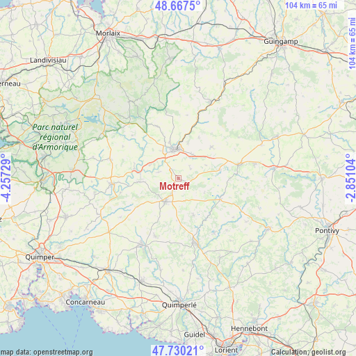
Motreff GPS coordinates[2]
48° 12' 3.6" North, 3° 33' 14.976" West
| Map corner | latitude | longitude |
|---|---|---|
| Upper-left | 48.6675°, | -4.25729° |
| Center: | 48.201°, | -3.55416° |
| Lower-right: | 47.73021°, | -2.85104° |
| Map W x H: | 104.2×104.2 km | = 64.7×64.7mi |
| max Lat: | 51.07786° ⇑37.1% North |
| Motreff: | 48.201° |
| min Lat: | ⇓62.9% South 41.3874° |
| min Long | Motreff | max Long |
| -5.08615° | -3.55416° | 9.52242° |
| W 1.6%⇐ | ⇒98.4% E |
Elevation
Elevation of Motreff is 211 m = 692 ft, and this is 17.3 m = 57 ft above average elevation for this country.
| Max E: |
2333 m = 7654 ft | 31.5% |
| Motreff | 211 m 692 ft | |
| Avg. | 193.7 m = 635 ft | |
Min E: |
-1 m = -3 ft | 68.5% |
See also: France elevation on elevation.city.
Geographical zone
Motreff is located in North temperate zone (between Tropic of Cancer and the Arctic Circle). Distance of this North polar circle is 2041.7 km =1268.7 mi to North.| Distance of | km | miles | from Motreff |
|---|---|---|---|
| North Pole | 4647.6 | 2887.9 | to North |
| Arctic Circle | 2041.7 | 1268.7 | to North |
| Tropic Cancer | 2753.5 | 1710.9 | to South |
| Equator | 5359.4 | 3330.2 | to South |


Nearby cities:
15 places around Motreff: (largest is in red/bold)
• Carhaix-Plouguer
8.5 km =5.3 mi,  350°
350°
• Cléden-Poher
9.4 km =5.8 mi,  294°
294°
• Glomel
11.9 km =7.4 mi,  78°
78°
• Gourin
8 km =5 mi,  209°
209°
• Kergloff
9.5 km =5.9 mi,  328°
328°
• Landeleau
13.2 km =8.2 mi,  282°
282°
• Langonnet
11.6 km =7.2 mi,  157°
157°
• Le Moustoir
8.2 km =5.1 mi,  26°
26°
• Le Saint
12.4 km =7.7 mi,  182°
182°
• Paule
9.1 km =5.7 mi,  64°
64°
• Plounévézel
11.5 km =7.1 mi,  342°
342°
• Plévin
4.4 km =2.7 mi,  66°
66°
• Saint-Hernin
6.1 km =3.8 mi, 286°
• Spézet
12 km =7.5 mi,  269°
269°
• Treffrin
11.4 km =7.1 mi,  14°
14°
Sources, notices
• [Note1] Compared only with cities in France existing in our database
• [Src1] Map data: © OpenStreetMap contributors (CC-BY-SA)
• [Src2] Other city data from geonames.org with taken over terms of usage.
• [Src3] Geographical zone / Annual Mean Temperature by Robert A. Rohde @ Wikipedia
