Pampelonne geodata
Pampelonne (Occitanie) is a populated place; located in France in Europe/Paris (GMT+2) time zone. With population of 698 people, there are 11822 cities with bigger population in this country. Compared to other cities in France, 86% of cities are located further ↑North; 53.6% of cities are located further →East and 90.3% of cities have lower elevation than Pampelonne. Note1


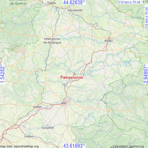
Pampelonne GPS coordinates[2]
44° 7' 25.716" North, 2° 14' 45.42" East
| Map corner | latitude | longitude |
|---|---|---|
| Upper-left | 44.62638°, | 1.54282° |
| Center: | 44.12381°, | 2.24595° |
| Lower-right: | 43.61693°, | 2.94907° |
| Map W x H: | 112.2×112.2 km | = 69.7×69.7mi |
| max Lat: | 51.07786° ⇑86% North |
| Pampelonne: | 44.12381° |
| min Lat: | ⇓14% South 41.3874° |
| min Long | Pampelonne | max Long |
| -5.08615° | 2.24595° | 9.52242° |
| W 46.4%⇐ | ⇒53.6% E |
Elevation
Elevation of Pampelonne is 433 m = 1421 ft, and this is 239.3 m = 785 ft above average elevation for this country.
| Max E: |
2333 m = 7654 ft | 9.7% |
| Pampelonne | 433 m 1421 ft | |
| Avg. | 193.7 m = 635 ft | |
Min E: |
-1 m = -3 ft | 90.3% |
See also: France elevation on elevation.city.
Geographical zone
Pampelonne is located in North temperate zone (between Tropic of Cancer and the Arctic Circle). Distance of this Northern Tropic circle is 2300.2 km =1429.3 mi to South.| Distance of | km | miles | from Pampelonne |
|---|---|---|---|
| North Pole | 5101 | 3169.6 | to North |
| Arctic Circle | 2495.1 | 1550.4 | to North |
| Tropic Cancer | 2300.2 | 1429.3 | to South |
| Equator | 4906.1 | 3048.5 | to South |


Nearby cities:
15 places around Pampelonne: (largest is in red/bold)
• Blaye-les-Mines
13.8 km =8.6 mi,  221°
221°
• Camjac
12.3 km =7.6 mi,  59°
59°
• Carmaux
10.7 km =6.6 mi, 220°
• Centrès
13.8 km =8.6 mi,  70°
70°
• La Salvetat-Peyralès
11.2 km =7 mi,  342°
342°
• Le Garric
14.3 km =8.9 mi,  207°
207°
• Mirandol-Bourgnounac
6.5 km =4 mi,  288°
288°
• Monestiés
13.3 km =8.3 mi,  241°
241°
• Naucelle
11.3 km =7 mi,  43°
43°
• Rosières
10.2 km =6.3 mi, 210°
• Saint-Benoît-de-Carmaux
12.4 km =7.7 mi,  228°
228°
• Sainte-Gemme
5.2 km =3.2 mi, 222°
• Sauveterre-de-Rouergue
12.2 km =7.6 mi,  28°
28°
• Tanus
6.2 km =3.9 mi,  113°
113°
• Valderiès
12.5 km =7.8 mi,  184°
184°
Sources, notices
• [Note1] Compared only with cities in France existing in our database
• [Src1] Map data: © OpenStreetMap contributors (CC-BY-SA)
• [Src2] Other city data from geonames.org with taken over terms of usage.
• [Src3] Geographical zone / Annual Mean Temperature by Robert A. Rohde @ Wikipedia
