Naucelle geodata
Naucelle (Occitanie) is a populated place; located in France in Europe/Paris (GMT+2) time zone. With population of 2,138 people, there are 4490 cities with bigger population in this country. Compared to other cities in France, 85.5% of cities are located further ↑North; 52% of cities are located further →East and 92.8% of cities have lower elevation than Naucelle. Note1
Administrative division(s):
- Level 1: Occitanie
- Level 2: Département de l'Aveyron
- Level 3: Arrondissement de Villefranche-de-Rouergue
- Level 4: Naucelle


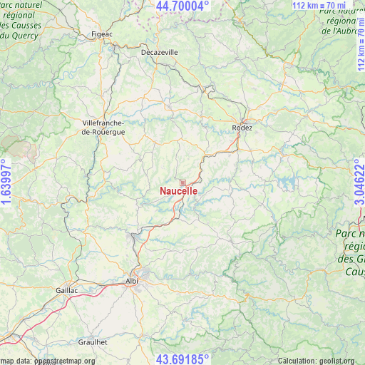
Naucelle GPS coordinates[2]
44° 11' 53.16" North, 2° 20' 35.16" East
| Map corner | latitude | longitude |
|---|---|---|
| Upper-left | 44.70004°, | 1.63997° |
| Center: | 44.1981°, | 2.3431° |
| Lower-right: | 43.69185°, | 3.04622° |
| Map W x H: | 112.1×112.1 km | = 69.7×69.7mi |
| max Lat: | 51.07786° ⇑85.5% North |
| Naucelle: | 44.1981° |
| min Lat: | ⇓14.5% South 41.3874° |
| min Long | Naucelle | max Long |
| -5.08615° | 2.3431° | 9.52242° |
| W 48%⇐ | ⇒52% E |
Elevation
Elevation of Naucelle is 500 m = 1640 ft, and this is 306.3 m = 1005 ft above average elevation for this country.
| Max E: |
2333 m = 7654 ft | 7.2% |
| Naucelle | 500 m 1640 ft | |
| Avg. | 193.7 m = 635 ft | |
Min E: |
-1 m = -3 ft | 92.8% |
See also: France elevation on elevation.city.
Geographical zone
Naucelle is located in North temperate zone (between Tropic of Cancer and the Arctic Circle). Distance of this Northern Tropic circle is 2308.4 km =1434.4 mi to South.| Distance of | km | miles | from Naucelle |
|---|---|---|---|
| North Pole | 5092.7 | 3164.5 | to North |
| Arctic Circle | 2486.8 | 1545.2 | to North |
| Tropic Cancer | 2308.4 | 1434.4 | to South |
| Equator | 4914.4 | 3053.7 | to South |


Nearby cities:
15 places around Naucelle: (largest is in red/bold)
• Baraqueville
11.2 km =7 mi,  39°
39°
• Calmont
14.6 km =9.1 mi,  67°
67°
• Camjac
3.5 km =2.2 mi,  124°
124°
• Cassagnes-Bégonhès
15.3 km =9.5 mi,  102°
102°
• Centrès
6.5 km =4 mi,  125°
125°
• Colombiès
16.2 km =10.1 mi,  358°
358°
• La Salvetat-Peyralès
11.4 km =7.1 mi,  281°
281°
• Lédergues
14.5 km =9 mi,  147°
147°
• Manhac
11.8 km =7.3 mi,  58°
58°
• Mirandol-Bourgnounac
15.2 km =9.4 mi,  246°
246°
• Pampelonne
11.3 km =7 mi,  223°
223°
• Quins
4.6 km =2.9 mi,  32°
32°
• Rieupeyroux
14.8 km =9.2 mi,  325°
325°
• Sauveterre-de-Rouergue
3.2 km =2 mi,  322°
322°
• Tanus
10.9 km =6.8 mi,  190°
190°
Sources, notices
• [Note1] Compared only with cities in France existing in our database
• [Src1] Map data: © OpenStreetMap contributors (CC-BY-SA)
• [Src2] Other city data from geonames.org with taken over terms of usage.
• [Src3] Geographical zone / Annual Mean Temperature by Robert A. Rohde @ Wikipedia
