Cagnotte geodata
Cagnotte (Nouvelle-Aquitaine) is a populated place; located in France in Europe/Paris (GMT+2) time zone. With population of 573 people, there are 13785 cities with bigger population in this country. Compared to other cities in France, 91.9% of cities are located further ↑North; 88.9% of cities are located further →East and 83.4% of cities have higher elevation than Cagnotte. Note1
Administrative division(s):
- Level 1: Nouvelle-Aquitaine
- Level 2: Landes
- Level 3: Arrondissement de Dax
- Level 4: Cagnotte


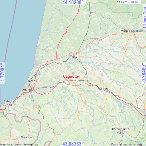
Cagnotte GPS coordinates[2]
43° 35' 42.036" North, 1° 4' 4.116" West
| Map corner | latitude | longitude |
|---|---|---|
| Upper-left | 44.10208°, | -1.77094° |
| Center: | 43.59501°, | -1.06781° |
| Lower-right: | 43.08363°, | -0.36469° |
| Map W x H: | 113.2×113.2 km | = 70.3×70.3mi |
| max Lat: | 51.07786° ⇑91.9% North |
| Cagnotte: | 43.59501° |
| min Lat: | ⇓8.1% South 41.3874° |
| min Long | Cagnotte | max Long |
| -5.08615° | -1.06781° | 9.52242° |
| W 11.1%⇐ | ⇒88.9% E |
Elevation
Elevation of Cagnotte is 46 m = 151 ft, and this is 147.7 m = 485 ft below average elevation for this country.
| Max E: |
2333 m = 7654 ft | 83.4% |
| Avg. | 193.7 m = 635 ft | |
| Cagnotte | 46 m = 151 ft | |
Min E: |
-1 m = -3 ft | 16.6% |
See also: France elevation on elevation.city.
Geographical zone
Cagnotte is located in North temperate zone (between Tropic of Cancer and the Arctic Circle). Distance of this Northern Tropic circle is 2241.4 km =1392.7 mi to South.| Distance of | km | miles | from Cagnotte |
|---|---|---|---|
| North Pole | 5159.8 | 3206.2 | to North |
| Arctic Circle | 2553.9 | 1586.9 | to North |
| Tropic Cancer | 2241.4 | 1392.7 | to South |
| Equator | 4847.3 | 3012 | to South |


Nearby cities:
15 places around Cagnotte: (largest is in red/bold)
• Cauneille
5.4 km =3.4 mi,  173°
173°
• Heugas
5.5 km =3.4 mi,  348°
348°
• Labatut
8.4 km =5.2 mi,  126°
126°
• Mimbaste
9.6 km =6 mi,  51°
51°
• Misson
8.8 km =5.5 mi,  92°
92°
• Oeyreluy
8.3 km =5.2 mi, 351°
• Orist
10.1 km =6.3 mi,  300°
300°
• Orthevielle
8 km =5 mi,  233°
233°
• Peyrehorade
6.4 km =4 mi,  216°
216°
• Port-de-Lanne
9.5 km =5.9 mi,  249°
249°
• Pouillon
5.6 km =3.5 mi,  78°
78°
• Saint-Lon-les-Mines
5.2 km =3.2 mi,  292°
292°
• Saint-Pandelon
8.7 km =5.4 mi,  15°
15°
• Seyresse
9.7 km =6 mi,  2°
2°
• Tercis-les-Bains
9 km =5.6 mi,  339°
339°
Sources, notices
• [Note1] Compared only with cities in France existing in our database
• [Src1] Map data: © OpenStreetMap contributors (CC-BY-SA)
• [Src2] Other city data from geonames.org with taken over terms of usage.
• [Src3] Geographical zone / Annual Mean Temperature by Robert A. Rohde @ Wikipedia
