Oeyreluy geodata
Oeyreluy (Nouvelle-Aquitaine) is a populated place; located in France in Europe/Paris (GMT+2) time zone. With population of 1,595 people, there are 5845 cities with bigger population in this country. Compared to other cities in France, 90.9% of cities are located further ↑North; 89% of cities are located further →East and 96% of cities have higher elevation than Oeyreluy. Note1
Administrative division(s):
- Level 1: Nouvelle-Aquitaine
- Level 2: Landes
- Level 3: Arrondissement de Dax
- Level 4: Oeyreluy


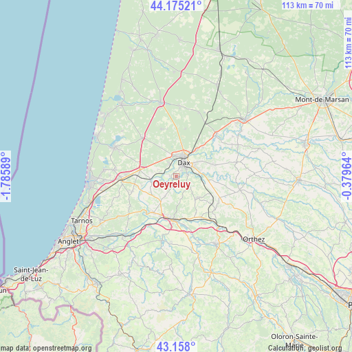
Oeyreluy GPS coordinates[2]
43° 40' 7.536" North, 1° 4' 57.936" West
| Map corner | latitude | longitude |
|---|---|---|
| Upper-left | 44.17521°, | -1.78589° |
| Center: | 43.66876°, | -1.08276° |
| Lower-right: | 43.158°, | -0.37964° |
| Map W x H: | 113.1×113.1 km | = 70.3×70.3mi |
| max Lat: | 51.07786° ⇑90.9% North |
| Oeyreluy: | 43.66876° |
| min Lat: | ⇓9.1% South 41.3874° |
| min Long | Oeyreluy | max Long |
| -5.08615° | -1.08276° | 9.52242° |
| W 11%⇐ | ⇒89% E |
Elevation
Elevation of Oeyreluy is 14 m = 46 ft, and this is 179.7 m = 590 ft below average elevation for this country.
| Max E: |
2333 m = 7654 ft | 96% |
| Avg. | 193.7 m = 635 ft | |
| Oeyreluy | 14 m = 46 ft | |
Min E: |
-1 m = -3 ft | 4% |
See also: France elevation on elevation.city.
Geographical zone
Oeyreluy is located in North temperate zone (between Tropic of Cancer and the Arctic Circle). Distance of this Northern Tropic circle is 2249.6 km =1397.8 mi to South.| Distance of | km | miles | from Oeyreluy |
|---|---|---|---|
| North Pole | 5151.6 | 3201.1 | to North |
| Arctic Circle | 2545.7 | 1581.8 | to North |
| Tropic Cancer | 2249.6 | 1397.8 | to South |
| Equator | 4855.5 | 3017.1 | to South |


Nearby cities:
15 places around Oeyreluy: (largest is in red/bold)
• Cagnotte
8.3 km =5.2 mi,  171°
171°
• Dax
5.2 km =3.2 mi,  26°
26°
• Heugas
2.8 km =1.7 mi,  177°
177°
• Mimbaste
9 km =5.6 mi,  104°
104°
• Mées
4.5 km =2.8 mi,  331°
331°
• Narrosse
7.2 km =4.5 mi,  57°
57°
• Orist
8.1 km =5 mi,  247°
247°
• Rivière-Saas-et-Gourby
5.5 km =3.4 mi,  282°
282°
• Saint-Lon-les-Mines
7.2 km =4.5 mi,  209°
209°
• Saint-Pandelon
3.5 km =2.2 mi,  86°
86°
• Saint-Paul-lès-Dax
7 km =4.3 mi,  21°
21°
• Saubusse
8.3 km =5.2 mi,  262°
262°
• Saugnac-et-Cambran
7.1 km =4.4 mi, 87°
• Seyresse
2.2 km =1.4 mi,  47°
47°
• Tercis-les-Bains
2 km =1.2 mi, 275°
Sources, notices
• [Note1] Compared only with cities in France existing in our database
• [Src1] Map data: © OpenStreetMap contributors (CC-BY-SA)
• [Src2] Other city data from geonames.org with taken over terms of usage.
• [Src3] Geographical zone / Annual Mean Temperature by Robert A. Rohde @ Wikipedia
