Ordan-Larroque geodata
Ordan-Larroque (Occitanie) is a populated place; located in France in Europe/Paris (GMT+2) time zone. With population of 816 people, there are 10420 cities with bigger population in this country. Compared to other cities in France, 90.6% of cities are located further ↑North; 73.8% of cities are located further →East and 61% of cities have lower elevation than Ordan-Larroque. Note1


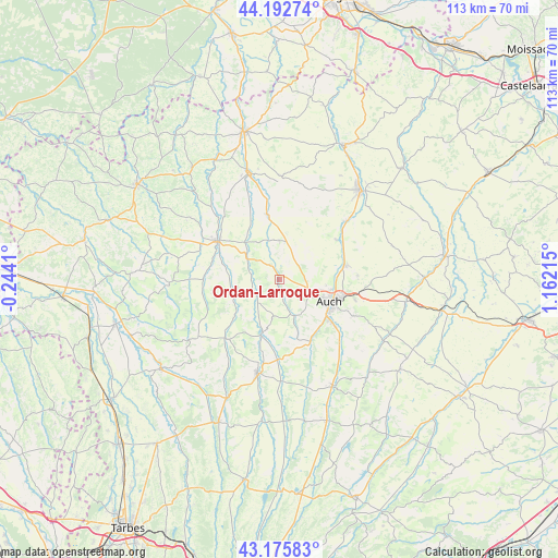
Ordan-Larroque GPS coordinates[2]
43° 41' 11.184" North, 0° 27' 32.472" East
| Map corner | latitude | longitude |
|---|---|---|
| Upper-left | 44.19274°, | -0.2441° |
| Center: | 43.68644°, | 0.45902° |
| Lower-right: | 43.17583°, | 1.16215° |
| Map W x H: | 113.1×113.1 km | = 70.3×70.3mi |
| max Lat: | 51.07786° ⇑90.6% North |
| Ordan-Larroque: | 43.68644° |
| min Lat: | ⇓9.4% South 41.3874° |
| min Long | Ordan-Larroque | max Long |
| -5.08615° | 0.45902° | 9.52242° |
| W 26.2%⇐ | ⇒73.8% E |
Elevation
Elevation of Ordan-Larroque is 175 m = 574 ft, and this is 18.7 m = 61 ft below average elevation for this country.
| Max E: |
2333 m = 7654 ft | 39% |
| Avg. | 193.7 m = 635 ft | |
| Ordan-Larroque | 175 m = 574 ft | |
Min E: |
-1 m = -3 ft | 61% |
See also: France elevation on elevation.city.
Geographical zone
Ordan-Larroque is located in North temperate zone (between Tropic of Cancer and the Arctic Circle). Distance of this Northern Tropic circle is 2251.6 km =1399.1 mi to South.| Distance of | km | miles | from Ordan-Larroque |
|---|---|---|---|
| North Pole | 5149.6 | 3199.8 | to North |
| Arctic Circle | 2543.7 | 1580.6 | to North |
| Tropic Cancer | 2251.6 | 1399.1 | to South |
| Equator | 4857.5 | 3018.3 | to South |


Nearby cities:
15 places around Ordan-Larroque: (largest is in red/bold)
• Auch
11.3 km =7 mi,  113°
113°
• Auterive
17 km =10.6 mi,  132°
132°
• Barran
7.7 km =4.8 mi,  189°
189°
• Castéra-Verduzan
13.4 km =8.3 mi,  350°
350°
• Duran
8.8 km =5.5 mi,  103°
103°
• Jegun
8.9 km =5.5 mi,  3°
3°
• Mirande
19.6 km =12.2 mi, 193°
• Montesquiou
15.9 km =9.9 mi,  220°
220°
• Montestruc-sur-Gers
18.2 km =11.3 mi,  48°
48°
• Pavie
13.6 km =8.5 mi, 128°
• Pessan
16.8 km =10.4 mi,  115°
115°
• Preignan
13.7 km =8.5 mi,  78°
78°
• Roquelaure
10.2 km =6.3 mi,  69°
69°
• Saint-Puy
21.2 km =13.2 mi, 0°
• Vic-Fezensac
15.1 km =9.4 mi,  309°
309°
Sources, notices
• [Note1] Compared only with cities in France existing in our database
• [Src1] Map data: © OpenStreetMap contributors (CC-BY-SA)
• [Src2] Other city data from geonames.org with taken over terms of usage.
• [Src3] Geographical zone / Annual Mean Temperature by Robert A. Rohde @ Wikipedia
