Oizé geodata
Oizé (Pays de la Loire) is a populated place; located in France in Europe/Paris (GMT+2) time zone. With population of 769 people, there are 10958 cities with bigger population in this country. Compared to other cities in France, 55.9% of cities are located further ↓South; 77.2% of cities are located further →East and 70.1% of cities have higher elevation than Oizé. Note1
Administrative division(s):
- Level 1: Pays de la Loire
- Level 2: Sarthe
- Level 3: Arrondissement de La Flèche
- Level 4: Oizé


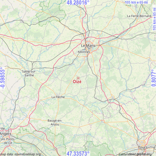
Oizé GPS coordinates[2]
47° 48' 36.324" North, 0° 6' 16.488" East
| Map corner | latitude | longitude |
|---|---|---|
| Upper-left | 48.28016°, | -0.59855° |
| Center: | 47.81009°, | 0.10458° |
| Lower-right: | 47.33573°, | 0.8077° |
| Map W x H: | 105×105 km | = 65.2×65.2mi |
| max Lat: | 51.07786° ⇑44.1% North |
| Oizé: | 47.81009° |
| min Lat: | ⇓55.9% South 41.3874° |
| min Long | Oizé | max Long |
| -5.08615° | 0.10458° | 9.52242° |
| W 22.8%⇐ | ⇒77.2% E |
Elevation
Elevation of Oizé is 78 m = 256 ft, and this is 115.7 m = 380 ft below average elevation for this country.
| Max E: |
2333 m = 7654 ft | 70.1% |
| Avg. | 193.7 m = 635 ft | |
| Oizé | 78 m = 256 ft | |
Min E: |
-1 m = -3 ft | 29.9% |
See also: France elevation on elevation.city.
Geographical zone
Oizé is located in North temperate zone (between Tropic of Cancer and the Arctic Circle). Distance of this North polar circle is 2085.2 km =1295.7 mi to North.| Distance of | km | miles | from Oizé |
|---|---|---|---|
| North Pole | 4691.1 | 2914.9 | to North |
| Arctic Circle | 2085.2 | 1295.7 | to North |
| Tropic Cancer | 2710.1 | 1684 | to South |
| Equator | 5316 | 3303.2 | to South |


Nearby cities:
15 places around Oizé: (largest is in red/bold)
• Cérans-Foulletourte
2.7 km =1.7 mi,  311°
311°
• Fillé
10.1 km =6.3 mi,  8°
8°
• Guécélard
7.7 km =4.8 mi, 13°
• La Suze-sur-Sarthe
10.5 km =6.5 mi,  325°
325°
• Mansigné
7.2 km =4.5 mi,  162°
162°
• Mézeray
9.3 km =5.8 mi,  281°
281°
• Parigné-le-Pôlin
4.4 km =2.7 mi,  2°
2°
• Pontvallain
9.2 km =5.7 mi,  135°
135°
• Requeil
5.1 km =3.2 mi,  124°
124°
• Roézé-sur-Sarthe
9.9 km =6.2 mi,  343°
343°
• Saint-Biez-en-Belin
10.1 km =6.3 mi,  83°
83°
• Saint-Gervais-en-Belin
11.3 km =7 mi,  48°
48°
• Saint-Jean-de-la-Motte
8.2 km =5.1 mi,  205°
205°
• Saint-Ouen-en-Belin
8.2 km =5.1 mi,  71°
71°
• Yvré-le-Pôlin
4.1 km =2.5 mi, 70°
Sources, notices
• [Note1] Compared only with cities in France existing in our database
• [Src1] Map data: © OpenStreetMap contributors (CC-BY-SA)
• [Src2] Other city data from geonames.org with taken over terms of usage.
• [Src3] Geographical zone / Annual Mean Temperature by Robert A. Rohde @ Wikipedia
