Mansigné geodata
Mansigné (Pays de la Loire) is a populated place; located in France in Europe/Paris (GMT+2) time zone. With population of 1,411 people, there are 6559 cities with bigger population in this country. Compared to other cities in France, 55% of cities are located further ↓South; 76.9% of cities are located further →East and 77.3% of cities have higher elevation than Mansigné. Note1
Administrative division(s):
- Level 1: Pays de la Loire
- Level 2: Sarthe
- Level 3: Arrondissement de La Flèche
- Level 4: Mansigné


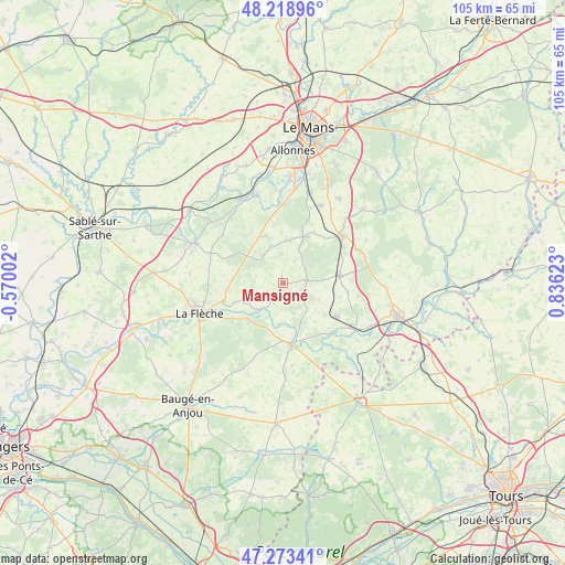
Mansigné GPS coordinates[2]
47° 44' 53.988" North, 0° 7' 59.196" East
| Map corner | latitude | longitude |
|---|---|---|
| Upper-left | 48.21896°, | -0.57002° |
| Center: | 47.74833°, | 0.13311° |
| Lower-right: | 47.27341°, | 0.83623° |
| Map W x H: | 105.1×105.1 km | = 65.3×65.3mi |
| max Lat: | 51.07786° ⇑45% North |
| Mansigné: | 47.74833° |
| min Lat: | ⇓55% South 41.3874° |
| min Long | Mansigné | max Long |
| -5.08615° | 0.13311° | 9.52242° |
| W 23.1%⇐ | ⇒76.9% E |
Elevation
Elevation of Mansigné is 61 m = 200 ft, and this is 132.7 m = 435 ft below average elevation for this country.
| Max E: |
2333 m = 7654 ft | 77.3% |
| Avg. | 193.7 m = 635 ft | |
| Mansigné | 61 m = 200 ft | |
Min E: |
-1 m = -3 ft | 22.7% |
See also: France elevation on elevation.city.
Geographical zone
Mansigné is located in North temperate zone (between Tropic of Cancer and the Arctic Circle). Distance of this North polar circle is 2092.1 km =1300 mi to North.| Distance of | km | miles | from Mansigné |
|---|---|---|---|
| North Pole | 4697.9 | 2919.1 | to North |
| Arctic Circle | 2092.1 | 1300 | to North |
| Tropic Cancer | 2703.2 | 1679.7 | to South |
| Equator | 5309.1 | 3298.9 | to South |


Nearby cities:
15 places around Mansigné: (largest is in red/bold)
• Clermont-Créans
11.5 km =7.1 mi,  253°
253°
• Coulongé
8.3 km =5.2 mi,  142°
142°
• Cérans-Foulletourte
9.6 km =6 mi,  334°
334°
• Le Lude
11.5 km =7.1 mi,  171°
171°
• Luché-Pringé
6.6 km =4.1 mi,  220°
220°
• Mareil-sur-Loir
9.9 km =6.2 mi, 247°
• Mayet
10.7 km =6.6 mi,  83°
83°
• Oizé
7.2 km =4.5 mi,  342°
342°
• Pontvallain
4.4 km =2.7 mi,  85°
85°
• Requeil
4.5 km =2.8 mi,  27°
27°
• Saint-Biez-en-Belin
11.3 km =7 mi,  44°
44°
• Saint-Jean-de-la-Motte
5.7 km =3.5 mi,  264°
264°
• Saint-Ouen-en-Belin
11 km =6.8 mi, 31°
• Thorée-les-Pins
9.6 km =6 mi, 224°
• Yvré-le-Pôlin
8.4 km =5.2 mi,  11°
11°
Sources, notices
• [Note1] Compared only with cities in France existing in our database
• [Src1] Map data: © OpenStreetMap contributors (CC-BY-SA)
• [Src2] Other city data from geonames.org with taken over terms of usage.
• [Src3] Geographical zone / Annual Mean Temperature by Robert A. Rohde @ Wikipedia
