Pontvallain geodata
Pontvallain (Pays de la Loire) is a populated place; located in France in Europe/Paris (GMT+2) time zone. With population of 1,350 people, there are 6810 cities with bigger population in this country. Compared to other cities in France, 55% of cities are located further ↓South; 76.4% of cities are located further →East and 79.8% of cities have higher elevation than Pontvallain. Note1
Administrative division(s):
- Level 1: Pays de la Loire
- Level 2: Sarthe
- Level 3: Arrondissement de La Flèche
- Level 4: Pontvallain


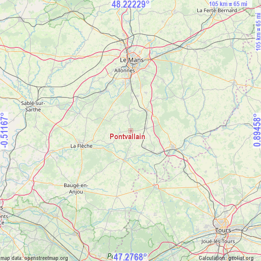
Pontvallain GPS coordinates[2]
47° 45' 6.084" North, 0° 11' 29.22" East
| Map corner | latitude | longitude |
|---|---|---|
| Upper-left | 48.22229°, | -0.51167° |
| Center: | 47.75169°, | 0.19145° |
| Lower-right: | 47.2768°, | 0.89458° |
| Map W x H: | 105.1×105.1 km | = 65.3×65.3mi |
| max Lat: | 51.07786° ⇑45% North |
| Pontvallain: | 47.75169° |
| min Lat: | ⇓55% South 41.3874° |
| min Long | Pontvallain | max Long |
| -5.08615° | 0.19145° | 9.52242° |
| W 23.6%⇐ | ⇒76.4% E |
Elevation
Elevation of Pontvallain is 55 m = 180 ft, and this is 138.7 m = 455 ft below average elevation for this country.
| Max E: |
2333 m = 7654 ft | 79.8% |
| Avg. | 193.7 m = 635 ft | |
| Pontvallain | 55 m = 180 ft | |
Min E: |
-1 m = -3 ft | 20.2% |
See also: France elevation on elevation.city.
Geographical zone
Pontvallain is located in North temperate zone (between Tropic of Cancer and the Arctic Circle). Distance of this North polar circle is 2091.7 km =1299.7 mi to North.| Distance of | km | miles | from Pontvallain |
|---|---|---|---|
| North Pole | 4697.6 | 2919 | to North |
| Arctic Circle | 2091.7 | 1299.7 | to North |
| Tropic Cancer | 2703.6 | 1679.9 | to South |
| Equator | 5309.5 | 3299.2 | to South |


Nearby cities:
15 places around Pontvallain: (largest is in red/bold)
• Aubigné-Racan
8.9 km =5.5 mi,  139°
139°
• Coulongé
7 km =4.3 mi,  173°
173°
• Cérans-Foulletourte
11.9 km =7.4 mi,  314°
314°
• Le Lude
12 km =7.5 mi,  192°
192°
• Luché-Pringé
10.2 km =6.3 mi,  238°
238°
• Mansigné
4.4 km =2.7 mi,  265°
265°
• Mayet
6.3 km =3.9 mi,  81°
81°
• Oizé
9.2 km =5.7 mi,  315°
315°
• Requeil
4.2 km =2.6 mi,  327°
327°
• Saint-Biez-en-Belin
8.5 km =5.3 mi,  24°
24°
• Saint-Jean-de-la-Motte
10.1 km =6.3 mi, 265°
• Saint-Ouen-en-Belin
9.1 km =5.7 mi,  8°
8°
• Verneil-le-Chétif
8 km =5 mi,  104°
104°
• Yvré-le-Pôlin
8.3 km =5.2 mi,  341°
341°
• Écommoy
10.3 km =6.4 mi,  36°
36°
Sources, notices
• [Note1] Compared only with cities in France existing in our database
• [Src1] Map data: © OpenStreetMap contributors (CC-BY-SA)
• [Src2] Other city data from geonames.org with taken over terms of usage.
• [Src3] Geographical zone / Annual Mean Temperature by Robert A. Rohde @ Wikipedia
