Cérans-Foulletourte geodata
Cérans-Foulletourte (Pays de la Loire) is a populated place; located in France in Europe/Paris (GMT+2) time zone. With population of 2,561 people, there are 3802 cities with bigger population in this country. Compared to other cities in France, 56.3% of cities are located further ↓South; 77.4% of cities are located further →East and 73.6% of cities have higher elevation than Cérans-Foulletourte. Note1
Administrative division(s):
- Level 1: Pays de la Loire
- Level 2: Sarthe
- Level 3: Arrondissement de La Flèche
- Level 4: Cérans-Foulletourte


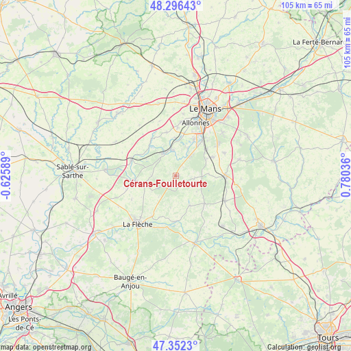
Cérans-Foulletourte GPS coordinates[2]
47° 49' 35.436" North, 0° 4' 38.064" East
| Map corner | latitude | longitude |
|---|---|---|
| Upper-left | 48.29643°, | -0.62589° |
| Center: | 47.82651°, | 0.07724° |
| Lower-right: | 47.3523°, | 0.78036° |
| Map W x H: | 105×105 km | = 65.2×65.2mi |
| max Lat: | 51.07786° ⇑43.7% North |
| Cérans-Foulletourte: | 47.82651° |
| min Lat: | ⇓56.3% South 41.3874° |
| min Long | Cérans-Foullet | max Long |
| -5.08615° | 0.07724° | 9.52242° |
| W 22.6%⇐ | ⇒77.4% E |
Elevation
Elevation of Cérans-Foulletourte is 70 m = 230 ft, and this is 123.7 m = 406 ft below average elevation for this country.
| Max E: |
2333 m = 7654 ft | 73.6% |
| Avg. | 193.7 m = 635 ft | |
| Cérans-Foulletourte | 70 m = 230 ft | |
Min E: |
-1 m = -3 ft | 26.4% |
See also: France elevation on elevation.city.
Geographical zone
Cérans-Foulletourte is located in North temperate zone (between Tropic of Cancer and the Arctic Circle). Distance of this North polar circle is 2083.4 km =1294.6 mi to North.| Distance of | km | miles | from Cérans-Foulletourte |
|---|---|---|---|
| North Pole | 4689.3 | 2913.8 | to North |
| Arctic Circle | 2083.4 | 1294.6 | to North |
| Tropic Cancer | 2711.9 | 1685.1 | to South |
| Equator | 5317.8 | 3304.3 | to South |


Nearby cities:
15 places around Cérans-Foulletourte: (largest is in red/bold)
• Fercé-sur-Sarthe
11.6 km =7.2 mi,  315°
315°
• Fillé
8.9 km =5.5 mi,  23°
23°
• Guécélard
6.9 km =4.3 mi,  34°
34°
• La Suze-sur-Sarthe
7.8 km =4.8 mi,  330°
330°
• Mansigné
9.6 km =6 mi,  154°
154°
• Mézeray
7.1 km =4.4 mi,  270°
270°
• Oizé
2.7 km =1.7 mi,  131°
131°
• Parigné-le-Pôlin
3.4 km =2.1 mi,  40°
40°
• Requeil
7.9 km =4.9 mi, 127°
• Roézé-sur-Sarthe
7.7 km =4.8 mi,  354°
354°
• Saint-Jean-de-la-Motte
9.3 km =5.8 mi,  189°
189°
• Saint-Jean-du-Bois
10 km =6.2 mi,  300°
300°
• Saint-Ouen-en-Belin
9.9 km =6.2 mi,  85°
85°
• Voivres-lès-le-Mans
11.5 km =7.1 mi,  358°
358°
• Yvré-le-Pôlin
5.9 km =3.7 mi, 94°
Sources, notices
• [Note1] Compared only with cities in France existing in our database
• [Src1] Map data: © OpenStreetMap contributors (CC-BY-SA)
• [Src2] Other city data from geonames.org with taken over terms of usage.
• [Src3] Geographical zone / Annual Mean Temperature by Robert A. Rohde @ Wikipedia
