Notre-Dame-de-Bondeville geodata
Notre-Dame-de-Bondeville (Normandy) is a populated place; located in France in Europe/Paris (GMT+2) time zone. With population of 7,817 people, there are 1242 cities with bigger population in this country. Compared to other cities in France, 89% of cities are located further ↓South; 68.3% of cities are located further →East and 91.6% of cities have higher elevation than Notre-Dame-de-Bondeville. Note1
Administrative division(s):
- Level 1: Normandy
- Level 2: Seine-Maritime
- Level 3: Arrondissement de Rouen
- Level 4: Notre-Dame-de-Bondeville
Current local time in Notre-Dame-de-Bondeville:
05:56 AM, WednesdayDifference from your time zone: hours


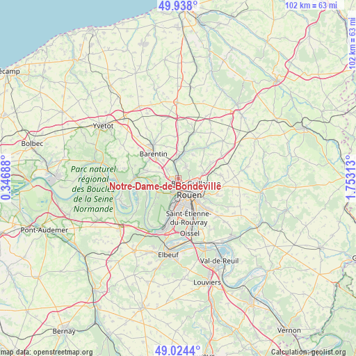
Notre-Dame-de-Bondeville GPS coordinates[2]
49° 28' 59.988" North, 1° 3' 0" East
| Map corner | latitude | longitude |
|---|---|---|
| Upper-left | 49.938°, | 0.34688° |
| Center: | 49.48333°, | 1.05° |
| Lower-right: | 49.0244°, | 1.75313° |
| Map W x H: | 101.6×101.6 km | = 63.1×63.1mi |
| max Lat: | 51.07786° ⇑11% North |
| Notre-Dame-de-Bondeville: | 49.48333° |
| min Lat: | ⇓89% South 41.3874° |
| min Long | Notre-Dame-de-B | max Long |
| -5.08615° | 1.05° | 9.52242° |
| W 31.7%⇐ | ⇒68.3% E |
Elevation
Elevation of Notre-Dame-de-Bondeville is 26 m = 85 ft, and this is 167.7 m = 550 ft below average elevation for this country.
| Max E: |
2333 m = 7654 ft | 91.6% |
| Avg. | 193.7 m = 635 ft | |
| Notre-Dame-de-Bondeville | 26 m = 85 ft | |
Min E: |
-1 m = -3 ft | 8.4% |
See also: France elevation on elevation.city.
Geographical zone
Notre-Dame-de-Bondeville is located in North temperate zone (between Tropic of Cancer and the Arctic Circle). Distance of this North polar circle is 1899.1 km =1180 mi to North.| Distance of | km | miles | from Notre-Dame-de-Bondeville |
|---|---|---|---|
| North Pole | 4505 | 2799.3 | to North |
| Arctic Circle | 1899.1 | 1180 | to North |
| Tropic Cancer | 2896.1 | 1799.6 | to South |
| Equator | 5502 | 3418.8 | to South |


Nearby cities:
15 places around Notre-Dame-de-Bondeville: (largest is in red/bold)
• Bihorel
6.1 km =3.8 mi,  121°
121°
• Bois-Guillaume
5.8 km =3.6 mi, 116°
• Canteleu
5.1 km =3.2 mi,  201°
201°
• Déville-lès-Rouen
1.6 km =1 mi,  174°
174°
• Houppeville
3.9 km =2.4 mi,  33°
33°
• Hénouville
6.3 km =3.9 mi,  265°
265°
• La Vaupalière
3.9 km =2.4 mi,  277°
277°
• Le Houlme
3.1 km =1.9 mi,  340°
340°
• Malaunay
4.9 km =3 mi,  354°
354°
• Maromme
1.9 km =1.2 mi,  256°
256°
• Mont-Saint-Aignan
3.9 km =2.4 mi,  125°
125°
• Montigny
4.4 km =2.7 mi,  232°
232°
• Rouen
5.7 km =3.5 mi,  141°
141°
• Roumare
6.2 km =3.9 mi,  298°
298°
• Saint-Jean-du-Cardonnay
3.7 km =2.3 mi,  310°
310°
Sources, notices
• [Note1] Compared only with cities in France existing in our database
• [Src1] Map data: © OpenStreetMap contributors (CC-BY-SA)
• [Src2] Other city data from geonames.org with taken over terms of usage.
• [Src3] Geographical zone / Annual Mean Temperature by Robert A. Rohde @ Wikipedia
