Déville-lès-Rouen geodata
Déville-lès-Rouen (Normandy) is a populated place; located in France in Europe/Paris (GMT+2) time zone. With population of 10,548 people, there are 905 cities with bigger population in this country. Compared to other cities in France, 88.8% of cities are located further ↓South; 68.3% of cities are located further →East and 86.7% of cities have higher elevation than Déville-lès-Rouen. Note1
Administrative division(s):
- Level 1: Normandy
- Level 2: Seine-Maritime
- Level 3: Arrondissement de Rouen
- Level 4: Déville-lès-Rouen


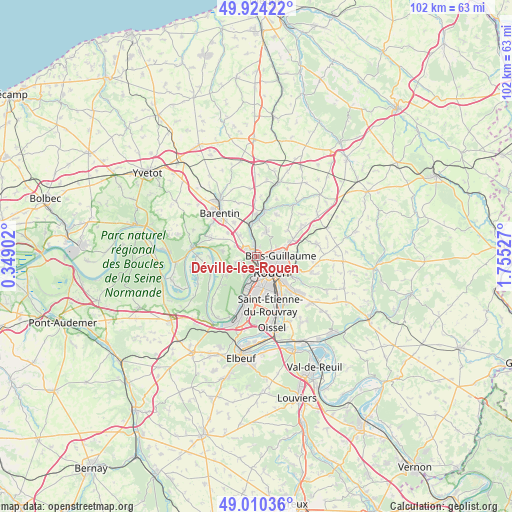
Déville-lès-Rouen GPS coordinates[2]
49° 28' 9.912" North, 1° 3' 7.704" East
| Map corner | latitude | longitude |
|---|---|---|
| Upper-left | 49.92422°, | 0.34902° |
| Center: | 49.46942°, | 1.05214° |
| Lower-right: | 49.01036°, | 1.75527° |
| Map W x H: | 101.6×101.6 km | = 63.1×63.1mi |
| max Lat: | 51.07786° ⇑11.2% North |
| Déville-lès-Rouen: | 49.46942° |
| min Lat: | ⇓88.8% South 41.3874° |
| min Long | Déville-lès-R | max Long |
| -5.08615° | 1.05214° | 9.52242° |
| W 31.7%⇐ | ⇒68.3% E |
Elevation
Elevation of Déville-lès-Rouen is 38 m = 125 ft, and this is 155.7 m = 511 ft below average elevation for this country.
| Max E: |
2333 m = 7654 ft | 86.7% |
| Avg. | 193.7 m = 635 ft | |
| Déville-lès-Rouen | 38 m = 125 ft | |
Min E: |
-1 m = -3 ft | 13.3% |
See also: France elevation on elevation.city.
Geographical zone
Déville-lès-Rouen is located in North temperate zone (between Tropic of Cancer and the Arctic Circle). Distance of this North polar circle is 1900.7 km =1181 mi to North.| Distance of | km | miles | from Déville-lès-Rouen |
|---|---|---|---|
| North Pole | 4506.6 | 2800.3 | to North |
| Arctic Circle | 1900.7 | 1181 | to North |
| Tropic Cancer | 2894.6 | 1798.6 | to South |
| Equator | 5500.5 | 3417.9 | to South |


Nearby cities:
15 places around Déville-lès-Rouen: (largest is in red/bold)
• Bihorel
5.3 km =3.3 mi,  107°
107°
• Bois-Guillaume
5.2 km =3.2 mi,  101°
101°
• Canteleu
3.8 km =2.4 mi,  211°
211°
• Houppeville
5.2 km =3.2 mi,  22°
22°
• Hénouville
6.5 km =4 mi,  279°
279°
• La Vaupalière
4.5 km =2.8 mi,  296°
296°
• Le Houlme
4.6 km =2.9 mi,  344°
344°
• Le Petit-Quevilly
6.3 km =3.9 mi,  173°
173°
• Malaunay
6.4 km =4 mi,  354°
354°
• Maromme
2.3 km =1.4 mi, 298°
• Mont-Saint-Aignan
3.1 km =1.9 mi, 103°
• Montigny
3.8 km =2.4 mi,  253°
253°
• Notre-Dame-de-Bondeville
1.6 km =1 mi, 354°
• Rouen
4.5 km =2.8 mi,  130°
130°
• Saint-Jean-du-Cardonnay
4.9 km =3 mi,  323°
323°
Sources, notices
• [Note1] Compared only with cities in France existing in our database
• [Src1] Map data: © OpenStreetMap contributors (CC-BY-SA)
• [Src2] Other city data from geonames.org with taken over terms of usage.
• [Src3] Geographical zone / Annual Mean Temperature by Robert A. Rohde @ Wikipedia
