Houppeville geodata
Houppeville (Normandy) is a populated place; located in France in Europe/Paris (GMT+2) time zone. With population of 2,472 people, there are 3929 cities with bigger population in this country. Compared to other cities in France, 89.5% of cities are located further ↓South; 68.1% of cities are located further →East and 55.6% of cities have lower elevation than Houppeville. Note1
Administrative division(s):
- Level 1: Normandy
- Level 2: Seine-Maritime
- Level 3: Arrondissement de Rouen
- Level 4: Houppeville


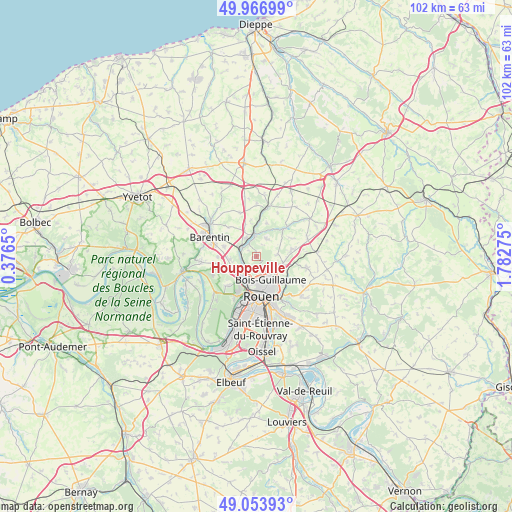
Houppeville GPS coordinates[2]
49° 30' 45.324" North, 1° 4' 46.632" East
| Map corner | latitude | longitude |
|---|---|---|
| Upper-left | 49.96699°, | 0.3765° |
| Center: | 49.51259°, | 1.07962° |
| Lower-right: | 49.05393°, | 1.78275° |
| Map W x H: | 101.5×101.5 km | = 63.1×63.1mi |
| max Lat: | 51.07786° ⇑10.5% North |
| Houppeville: | 49.51259° |
| min Lat: | ⇓89.5% South 41.3874° |
| min Long | Houppeville | max Long |
| -5.08615° | 1.07962° | 9.52242° |
| W 31.9%⇐ | ⇒68.1% E |
Elevation
Elevation of Houppeville is 152 m = 499 ft, and this is 41.7 m = 137 ft below average elevation for this country.
| Max E: |
2333 m = 7654 ft | 44.4% |
| Avg. | 193.7 m = 635 ft | |
| Houppeville | 152 m = 499 ft | |
Min E: |
-1 m = -3 ft | 55.6% |
See also: France elevation on elevation.city.
Geographical zone
Houppeville is located in North temperate zone (between Tropic of Cancer and the Arctic Circle). Distance of this North polar circle is 1895.9 km =1178.1 mi to North.| Distance of | km | miles | from Houppeville |
|---|---|---|---|
| North Pole | 4501.8 | 2797.3 | to North |
| Arctic Circle | 1895.9 | 1178.1 | to North |
| Tropic Cancer | 2899.4 | 1801.6 | to South |
| Equator | 5505.3 | 3420.8 | to South |


Nearby cities:
15 places around Houppeville: (largest is in red/bold)
• Anceaumeville
6.9 km =4.3 mi,  342°
342°
• Bois-Guillaume
6.6 km =4.1 mi,  152°
152°
• Bosc-Guérard-Saint-Adrien
4.2 km =2.6 mi,  39°
39°
• Déville-lès-Rouen
5.2 km =3.2 mi,  202°
202°
• Eslettes
4.3 km =2.7 mi, 335°
• Isneauville
5.6 km =3.5 mi,  106°
106°
• La Vaupalière
6.6 km =4.1 mi,  245°
245°
• Le Houlme
3.2 km =2 mi,  264°
264°
• Malaunay
3.1 km =1.9 mi,  301°
301°
• Maromme
5.5 km =3.4 mi,  227°
227°
• Mont-Cauvaire
6.8 km =4.2 mi,  18°
18°
• Mont-Saint-Aignan
5.6 km =3.5 mi,  169°
169°
• Notre-Dame-de-Bondeville
3.9 km =2.4 mi,  213°
213°
• Pissy-Pôville
6.6 km =4.1 mi,  287°
287°
• Saint-Jean-du-Cardonnay
5 km =3.1 mi, 259°
Sources, notices
• [Note1] Compared only with cities in France existing in our database
• [Src1] Map data: © OpenStreetMap contributors (CC-BY-SA)
• [Src2] Other city data from geonames.org with taken over terms of usage.
• [Src3] Geographical zone / Annual Mean Temperature by Robert A. Rohde @ Wikipedia
