Nort-sur-Erdre geodata
Nort-sur-Erdre (Pays de la Loire) is a populated place; located in France in Europe/Paris (GMT+2) time zone. With population of 6,461 people, there are 1529 cities with bigger population in this country. Compared to other cities in France, 50.3% of cities are located further ↓South; 92.2% of cities are located further →East and 98.2% of cities have higher elevation than Nort-sur-Erdre. Note1
Administrative division(s):
- Level 1: Pays de la Loire
- Level 2: Loire-Atlantique
- Level 3: Arrondissement of Châteaubriant-Ancenis
- Level 4: Nort-sur-Erdre


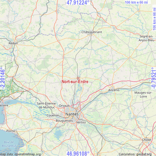
Nort-sur-Erdre GPS coordinates[2]
47° 26' 19.716" North, 1° 29' 53.988" West
| Map corner | latitude | longitude |
|---|---|---|
| Upper-left | 47.91224°, | -2.20146° |
| Center: | 47.43881°, | -1.49833° |
| Lower-right: | 46.96108°, | -0.79521° |
| Map W x H: | 105.8×105.8 km | = 65.7×65.7mi |
| max Lat: | 51.07786° ⇑49.7% North |
| Nort-sur-Erdre: | 47.43881° |
| min Lat: | ⇓50.3% South 41.3874° |
| min Long | Nort-sur-Erdre | max Long |
| -5.08615° | -1.49833° | 9.52242° |
| W 7.8%⇐ | ⇒92.2% E |
Elevation
Elevation of Nort-sur-Erdre is 8 m = 26 ft, and this is 185.7 m = 609 ft below average elevation for this country.
| Max E: |
2333 m = 7654 ft | 98.2% |
| Avg. | 193.7 m = 635 ft | |
| Nort-sur-Erdre | 8 m = 26 ft | |
Min E: |
-1 m = -3 ft | 1.8% |
See also: France elevation on elevation.city.
Geographical zone
Nort-sur-Erdre is located in North temperate zone (between Tropic of Cancer and the Arctic Circle). Distance of this North polar circle is 2126.5 km =1321.3 mi to North.| Distance of | km | miles | from Nort-sur-Erdre |
|---|---|---|---|
| North Pole | 4732.4 | 2940.6 | to North |
| Arctic Circle | 2126.5 | 1321.3 | to North |
| Tropic Cancer | 2668.8 | 1658.3 | to South |
| Equator | 5274.7 | 3277.5 | to South |


Nearby cities:
15 places around Nort-sur-Erdre: (largest is in red/bold)
• Abbaretz
13 km =8.1 mi,  348°
348°
• Bourg de Joué-sur-Erdre
8.6 km =5.3 mi,  42°
42°
• Casson
7.2 km =4.5 mi,  217°
217°
• Héric
12 km =7.5 mi,  256°
256°
• La Chevallerais
13.4 km =8.3 mi,  284°
284°
• Les Touches
5.1 km =3.2 mi,  85°
85°
• Ligné
9.6 km =6 mi,  108°
108°
• Mouzeil
11.4 km =7.1 mi, 85°
• Petit-Mars
6 km =3.7 mi,  144°
144°
• Puceul
12.8 km =8 mi,  316°
316°
• Saffré
9.2 km =5.7 mi, 319°
• Saint-Mars-du-Désert
10.7 km =6.6 mi, 139°
• Sucé-sur-Erdre
12 km =7.5 mi,  192°
192°
• Trans-sur-Erdre
10.2 km =6.3 mi,  65°
65°
• Treillières
15.1 km =9.4 mi, 217°
Sources, notices
• [Note1] Compared only with cities in France existing in our database
• [Src1] Map data: © OpenStreetMap contributors (CC-BY-SA)
• [Src2] Other city data from geonames.org with taken over terms of usage.
• [Src3] Geographical zone / Annual Mean Temperature by Robert A. Rohde @ Wikipedia
