Ligné geodata
Ligné (Pays de la Loire) is a populated place; located in France in Europe/Paris (GMT+2) time zone. With population of 3,222 people, there are 3028 cities with bigger population in this country. Compared to other cities in France, 50% of cities are located further ↓South; 91.3% of cities are located further →East and 87.4% of cities have higher elevation than Ligné. Note1
Administrative division(s):
- Level 1: Pays de la Loire
- Level 2: Loire-Atlantique
- Level 3: Arrondissement of Châteaubriant-Ancenis
- Level 4: Ligné


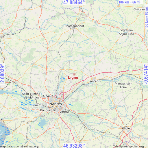
Ligné GPS coordinates[2]
47° 24' 39.456" North, 1° 22' 38.136" West
| Map corner | latitude | longitude |
|---|---|---|
| Upper-left | 47.88464°, | -2.08039° |
| Center: | 47.41096°, | -1.37726° |
| Lower-right: | 46.93298°, | -0.67414° |
| Map W x H: | 105.8×105.8 km | = 65.7×65.7mi |
| max Lat: | 51.07786° ⇑50% North |
| Ligné: | 47.41096° |
| min Lat: | ⇓50% South 41.3874° |
| min Long | Ligné | max Long |
| -5.08615° | -1.37726° | 9.52242° |
| W 8.7%⇐ | ⇒91.3% E |
Elevation
Elevation of Ligné is 36 m = 118 ft, and this is 157.7 m = 517 ft below average elevation for this country.
| Max E: |
2333 m = 7654 ft | 87.4% |
| Avg. | 193.7 m = 635 ft | |
| Ligné | 36 m = 118 ft | |
Min E: |
-1 m = -3 ft | 12.6% |
See also: France elevation on elevation.city.
Geographical zone
Ligné is located in North temperate zone (between Tropic of Cancer and the Arctic Circle). Distance of this North polar circle is 2129.6 km =1323.3 mi to North.| Distance of | km | miles | from Ligné |
|---|---|---|---|
| North Pole | 4735.5 | 2942.5 | to North |
| Arctic Circle | 2129.6 | 1323.3 | to North |
| Tropic Cancer | 2665.7 | 1656.4 | to South |
| Equator | 5271.6 | 3275.6 | to South |


Nearby cities:
15 places around Ligné: (largest is in red/bold)
• Bourg de Joué-sur-Erdre
10 km =6.2 mi,  341°
341°
• Champtoceaux
12.2 km =7.6 mi,  134°
134°
• Couffé
6.7 km =4.2 mi,  109°
109°
• La Varenne
11.9 km =7.4 mi,  158°
158°
• Le Cellier
10.4 km =6.5 mi,  166°
166°
• Les Touches
5.3 km =3.3 mi,  310°
310°
• Mauves-sur-Loire
12.7 km =7.9 mi,  183°
183°
• Mouzeil
4.6 km =2.9 mi,  28°
28°
• Mésanger
11.5 km =7.1 mi,  78°
78°
• Nort-sur-Erdre
9.6 km =6 mi,  288°
288°
• Oudon
9.9 km =6.2 mi,  135°
135°
• Petit-Mars
5.9 km =3.7 mi,  252°
252°
• Saint-Mars-du-Désert
5.5 km =3.4 mi,  203°
203°
• Teillé
9.4 km =5.8 mi,  52°
52°
• Trans-sur-Erdre
7.3 km =4.5 mi,  1°
1°
Sources, notices
• [Note1] Compared only with cities in France existing in our database
• [Src1] Map data: © OpenStreetMap contributors (CC-BY-SA)
• [Src2] Other city data from geonames.org with taken over terms of usage.
• [Src3] Geographical zone / Annual Mean Temperature by Robert A. Rohde @ Wikipedia
