Niergnies geodata
Niergnies (Hauts-de-France) is a populated place; located in France in Europe/Paris (GMT+2) time zone. With population of 516 people, there are 14910 cities with bigger population in this country. Compared to other cities in France, 94.5% of cities are located further ↓South; 61.4% of cities are located further ←West and 64.9% of cities have higher elevation than Niergnies. Note1
Administrative division(s):
- Level 1: Hauts-de-France
- Level 2: Nord
- Level 3: Arrondissement de Cambrai
- Level 4: Niergnies


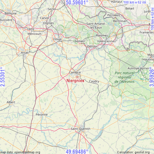
Niergnies GPS coordinates[2]
50° 8' 51.216" North, 3° 15' 22.104" East
| Map corner | latitude | longitude |
|---|---|---|
| Upper-left | 50.59601°, | 2.55301° |
| Center: | 50.14756°, | 3.25614° |
| Lower-right: | 49.69486°, | 3.95926° |
| Map W x H: | 100.2×100.2 km | = 62.3×62.3mi |
| max Lat: | 51.07786° ⇑5.5% North |
| Niergnies: | 50.14756° |
| min Lat: | ⇓94.5% South 41.3874° |
| min Long | Niergnies | max Long |
| -5.08615° | 3.25614° | 9.52242° |
| W 61.4%⇐ | ⇒38.6% E |
Elevation
Elevation of Niergnies is 90 m = 295 ft, and this is 103.7 m = 340 ft below average elevation for this country.
| Max E: |
2333 m = 7654 ft | 64.9% |
| Avg. | 193.7 m = 635 ft | |
| Niergnies | 90 m = 295 ft | |
Min E: |
-1 m = -3 ft | 35.1% |
See also: France elevation on elevation.city.
Geographical zone
Niergnies is located in North temperate zone (between Tropic of Cancer and the Arctic Circle). Distance of this North polar circle is 1825.3 km =1134.2 mi to North.| Distance of | km | miles | from Niergnies |
|---|---|---|---|
| North Pole | 4431.2 | 2753.4 | to North |
| Arctic Circle | 1825.3 | 1134.2 | to North |
| Tropic Cancer | 2970 | 1845.5 | to South |
| Equator | 5575.9 | 3464.7 | to South |


Nearby cities:
15 places around Niergnies: (largest is in red/bold)
• Awoingt
2 km =1.2 mi,  64°
64°
• Cambrai
3.5 km =2.2 mi,  334°
334°
• Cattenières
5.8 km =3.6 mi,  104°
104°
• Cauroir
4.4 km =2.7 mi,  49°
49°
• Escaudœuvres
5.9 km =3.7 mi,  7°
7°
• Esnes
6.6 km =4.1 mi,  141°
141°
• Les Rues-des-Vignes
5.9 km =3.7 mi,  192°
192°
• Marcoing
6.6 km =4.1 mi,  243°
243°
• Masnières
5 km =3.1 mi,  222°
222°
• Neuville-Saint-Rémy
4.9 km =3 mi, 331°
• Noyelles-sur-Escaut
5.4 km =3.4 mi,  253°
253°
• Proville
3.9 km =2.4 mi,  293°
293°
• Ramillies
6.4 km =4 mi,  3°
3°
• Rumilly-en-Cambrésis
3.5 km =2.2 mi,  229°
229°
• Tilloy-lez-Cambrai
6.5 km =4 mi, 334°
Sources, notices
• [Note1] Compared only with cities in France existing in our database
• [Src1] Map data: © OpenStreetMap contributors (CC-BY-SA)
• [Src2] Other city data from geonames.org with taken over terms of usage.
• [Src3] Geographical zone / Annual Mean Temperature by Robert A. Rohde @ Wikipedia
