Escaudœuvres geodata
Escaudœuvres (Hauts-de-France) is a populated place; located in France in Europe/Paris (GMT+2) time zone. With population of 3,375 people, there are 2884 cities with bigger population in this country. Compared to other cities in France, 94.8% of cities are located further ↓South; 61.6% of cities are located further ←West and 81.8% of cities have higher elevation than Escaudœuvres. Note1
Administrative division(s):
- Level 1: Hauts-de-France
- Level 2: Nord
- Level 3: Arrondissement de Cambrai
- Level 4: Escaudœuvres


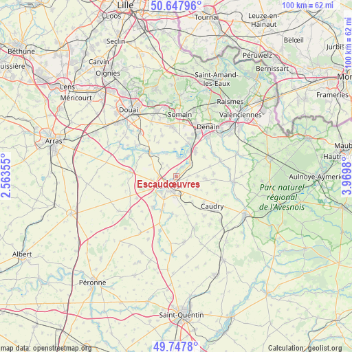
Escaudœuvres GPS coordinates[2]
50° 12' 0" North, 3° 16' 0.012" East
| Map corner | latitude | longitude |
|---|---|---|
| Upper-left | 50.64796°, | 2.56355° |
| Center: | 50.2°, | 3.26667° |
| Lower-right: | 49.7478°, | 3.9698° |
| Map W x H: | 100.1×100.1 km | = 62.2×62.2mi |
| max Lat: | 51.07786° ⇑5.2% North |
| Escaudœuvres: | 50.2° |
| min Lat: | ⇓94.8% South 41.3874° |
| min Long | Escaudœuvres | max Long |
| -5.08615° | 3.26667° | 9.52242° |
| W 61.6%⇐ | ⇒38.4% E |
Elevation
Elevation of Escaudœuvres is 50 m = 164 ft, and this is 143.7 m = 471 ft below average elevation for this country.
| Max E: |
2333 m = 7654 ft | 81.8% |
| Avg. | 193.7 m = 635 ft | |
| Escaudœuvres | 50 m = 164 ft | |
Min E: |
-1 m = -3 ft | 18.2% |
See also: France elevation on elevation.city.
Geographical zone
Escaudœuvres is located in North temperate zone (between Tropic of Cancer and the Arctic Circle). Distance of this North polar circle is 1819.5 km =1130.6 mi to North.| Distance of | km | miles | from Escaudœuvres |
|---|---|---|---|
| North Pole | 4425.3 | 2749.8 | to North |
| Arctic Circle | 1819.5 | 1130.6 | to North |
| Tropic Cancer | 2975.8 | 1849.1 | to South |
| Equator | 5581.7 | 3468.3 | to South |


Nearby cities:
15 places around Escaudœuvres: (largest is in red/bold)
• Awoingt
5.1 km =3.2 mi,  167°
167°
• Cambrai
3.5 km =2.2 mi,  220°
220°
• Carnières
6.7 km =4.2 mi,  121°
121°
• Cauroir
3.9 km =2.4 mi,  139°
139°
• Hem-Lenglet
7 km =4.3 mi,  337°
337°
• Iwuy
5.3 km =3.3 mi,  46°
46°
• Naves
3.6 km =2.2 mi,  84°
84°
• Neuville-Saint-Rémy
3.4 km =2.1 mi,  243°
243°
• Niergnies
5.9 km =3.7 mi,  187°
187°
• Paillencourt
5.2 km =3.2 mi,  5°
5°
• Proville
6.1 km =3.8 mi,  225°
225°
• Raillencourt-Sainte-Olle
7.4 km =4.6 mi,  255°
255°
• Ramillies
0.7 km =0.4 mi,  327°
327°
• Rieux-en-Cambrésis
6.1 km =3.8 mi,  89°
89°
• Tilloy-lez-Cambrai
3.6 km =2.2 mi,  270°
270°
Sources, notices
• [Note1] Compared only with cities in France existing in our database
• [Src1] Map data: © OpenStreetMap contributors (CC-BY-SA)
• [Src2] Other city data from geonames.org with taken over terms of usage.
• [Src3] Geographical zone / Annual Mean Temperature by Robert A. Rohde @ Wikipedia
