Nauroy geodata
Nauroy (Hauts-de-France) is a populated place; located in France in Europe/Paris (GMT+2) time zone. With population of 689 people, there are 11953 cities with bigger population in this country. Compared to other cities in France, 93.3% of cities are located further ↓South; 61.4% of cities are located further ←West and 53.6% of cities have lower elevation than Nauroy. Note1
Administrative division(s):
- Level 1: Hauts-de-France
- Level 2: Département de l'Aisne
- Level 3: Arrondissement de Saint-Quentin
- Level 4: Nauroy


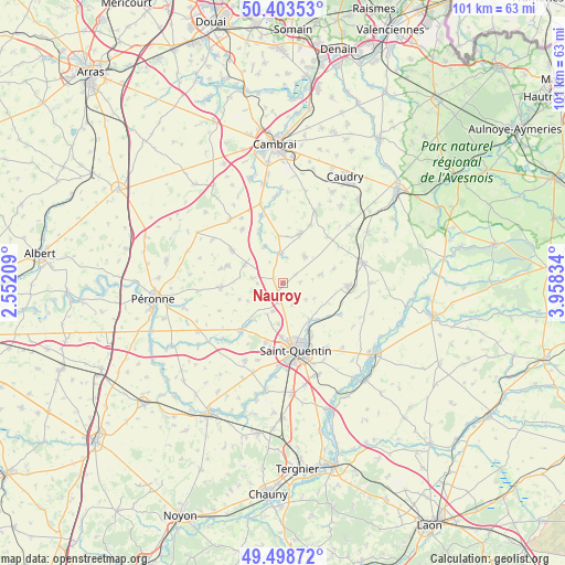
Nauroy GPS coordinates[2]
49° 57' 11.7" North, 3° 15' 18.756" East
| Map corner | latitude | longitude |
|---|---|---|
| Upper-left | 50.40353°, | 2.55209° |
| Center: | 49.95325°, | 3.25521° |
| Lower-right: | 49.49872°, | 3.95834° |
| Map W x H: | 100.6×100.6 km | = 62.5×62.5mi |
| max Lat: | 51.07786° ⇑6.7% North |
| Nauroy: | 49.95325° |
| min Lat: | ⇓93.3% South 41.3874° |
| min Long | Nauroy | max Long |
| -5.08615° | 3.25521° | 9.52242° |
| W 61.4%⇐ | ⇒38.6% E |
Elevation
Elevation of Nauroy is 145 m = 476 ft, and this is 48.7 m = 160 ft below average elevation for this country.
| Max E: |
2333 m = 7654 ft | 46.4% |
| Avg. | 193.7 m = 635 ft | |
| Nauroy | 145 m = 476 ft | |
Min E: |
-1 m = -3 ft | 53.6% |
See also: France elevation on elevation.city.
Geographical zone
Nauroy is located in North temperate zone (between Tropic of Cancer and the Arctic Circle). Distance of this North polar circle is 1846.9 km =1147.6 mi to North.| Distance of | km | miles | from Nauroy |
|---|---|---|---|
| North Pole | 4452.8 | 2766.8 | to North |
| Arctic Circle | 1846.9 | 1147.6 | to North |
| Tropic Cancer | 2948.4 | 1832.1 | to South |
| Equator | 5554.3 | 3451.3 | to South |


Nearby cities:
15 places around Nauroy: (largest is in red/bold)
• Beaurevoir
6.2 km =3.9 mi,  38°
38°
• Bellicourt
1.7 km =1.1 mi,  304°
304°
• Brancourt-le-Grand
9.4 km =5.8 mi,  74°
74°
• Fayet
9.4 km =5.8 mi,  181°
181°
• Gouy
5.3 km =3.3 mi,  0°
0°
• Gricourt
7.4 km =4.6 mi,  186°
186°
• Hargicourt
5.5 km =3.4 mi,  279°
279°
• Honnecourt-sur-Escaut
9.7 km =6 mi,  336°
336°
• Lesdins
8.2 km =5.1 mi,  139°
139°
• Levergies
5.1 km =3.2 mi,  126°
126°
• Montbrehain
6.9 km =4.3 mi,  77°
77°
• Morcourt
10 km =6.2 mi,  150°
150°
• Omissy
9.4 km =5.8 mi, 154°
• Ronssoy
7.6 km =4.7 mi, 295°
• Villers-Outréaux
9.7 km =6 mi,  18°
18°
Sources, notices
• [Note1] Compared only with cities in France existing in our database
• [Src1] Map data: © OpenStreetMap contributors (CC-BY-SA)
• [Src2] Other city data from geonames.org with taken over terms of usage.
• [Src3] Geographical zone / Annual Mean Temperature by Robert A. Rohde @ Wikipedia
