Nanteuil-le-Haudouin geodata
Nanteuil-le-Haudouin (Hauts-de-France) is a populated place; located in France in Europe/Paris (GMT+2) time zone. With population of 3,359 people, there are 2903 cities with bigger population in this country. Compared to other cities in France, 83.1% of cities are located further ↓South; 55.1% of cities are located further ←West and 64% of cities have higher elevation than Nanteuil-le-Haudouin. Note1
Administrative division(s):
- Level 1: Hauts-de-France
- Level 2: Département de l'Oise
- Level 3: Arrondissement de Senlis
- Level 4: Nanteuil-le-Haudouin


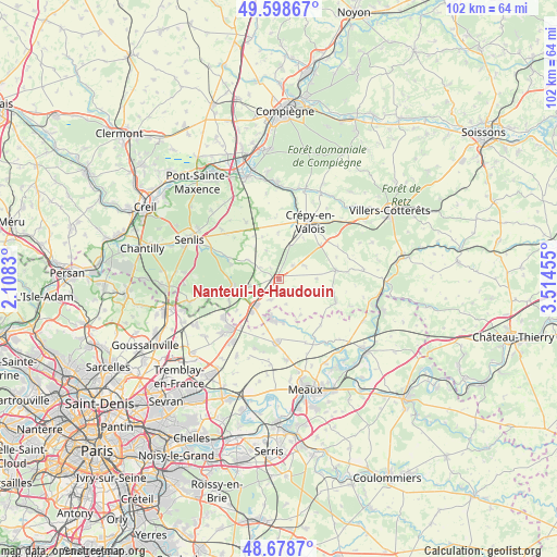
Nanteuil-le-Haudouin GPS coordinates[2]
49° 8' 26.952" North, 2° 48' 41.112" East
| Map corner | latitude | longitude |
|---|---|---|
| Upper-left | 49.59867°, | 2.1083° |
| Center: | 49.14082°, | 2.81142° |
| Lower-right: | 48.6787°, | 3.51455° |
| Map W x H: | 102.3×102.3 km | = 63.6×63.6mi |
| max Lat: | 51.07786° ⇑16.9% North |
| Nanteuil-le-Haudouin: | 49.14082° |
| min Lat: | ⇓83.1% South 41.3874° |
| min Long | Nanteuil-le-Hau | max Long |
| -5.08615° | 2.81142° | 9.52242° |
| W 55.1%⇐ | ⇒44.9% E |
Elevation
Elevation of Nanteuil-le-Haudouin is 92 m = 302 ft, and this is 101.7 m = 334 ft below average elevation for this country.
| Max E: |
2333 m = 7654 ft | 64% |
| Avg. | 193.7 m = 635 ft | |
| Nanteuil-le-Haudouin | 92 m = 302 ft | |
Min E: |
-1 m = -3 ft | 36% |
See also: France elevation on elevation.city.
Geographical zone
Nanteuil-le-Haudouin is located in North temperate zone (between Tropic of Cancer and the Arctic Circle). Distance of this North polar circle is 1937.2 km =1203.7 mi to North.| Distance of | km | miles | from Nanteuil-le-Haudouin |
|---|---|---|---|
| North Pole | 4543.1 | 2823 | to North |
| Arctic Circle | 1937.2 | 1203.7 | to North |
| Tropic Cancer | 2858 | 1775.9 | to South |
| Equator | 5463.9 | 3395.1 | to South |


Nearby cities:
15 places around Nanteuil-le-Haudouin: (largest is in red/bold)
• Acy-en-Multien
11.2 km =7 mi,  111°
111°
• Baron
6.9 km =4.3 mi,  301°
301°
• Betz
10.6 km =6.6 mi,  81°
81°
• Boissy-Fresnoy
5 km =3.1 mi,  58°
58°
• Brégy
7.6 km =4.7 mi,  148°
148°
• Ermenonville
8.4 km =5.2 mi,  259°
259°
• Lagny-le-Sec
7.7 km =4.8 mi,  219°
219°
• Le Plessis-Belleville
6.5 km =4 mi, 218°
• Lévignen
10.1 km =6.3 mi,  49°
49°
• Oissery
7.8 km =4.8 mi,  176°
176°
• Péroy-les-Gombries
3.5 km =2.2 mi, 45°
• Rouvres
11.1 km =6.9 mi, 218°
• Saint-Pathus
7.8 km =4.8 mi,  186°
186°
• Silly-le-Long
4 km =2.5 mi,  200°
200°
• Ver-sur-Launette
10.1 km =6.3 mi,  246°
246°
Sources, notices
• [Note1] Compared only with cities in France existing in our database
• [Src1] Map data: © OpenStreetMap contributors (CC-BY-SA)
• [Src2] Other city data from geonames.org with taken over terms of usage.
• [Src3] Geographical zone / Annual Mean Temperature by Robert A. Rohde @ Wikipedia
