Brégy geodata
Brégy (Hauts-de-France) is a populated place; located in France in Europe/Paris (GMT+2) time zone. With population of 502 people, there are 15200 cities with bigger population in this country. Compared to other cities in France, 81.7% of cities are located further ↓South; 55.9% of cities are located further ←West and 60.8% of cities have higher elevation than Brégy. Note1
Administrative division(s):
- Level 1: Hauts-de-France
- Level 2: Département de l'Oise
- Level 3: Arrondissement de Senlis
- Level 4: Brégy


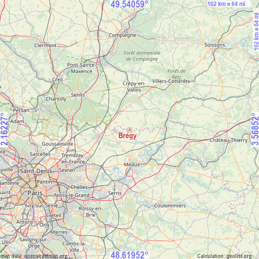
Brégy GPS coordinates[2]
49° 4' 55.884" North, 2° 51' 55.44" East
| Map corner | latitude | longitude |
|---|---|---|
| Upper-left | 49.54059°, | 2.16227° |
| Center: | 49.08219°, | 2.8654° |
| Lower-right: | 48.61952°, | 3.56852° |
| Map W x H: | 102.4×102.4 km | = 63.6×63.6mi |
| max Lat: | 51.07786° ⇑18.3% North |
| Brégy: | 49.08219° |
| min Lat: | ⇓81.7% South 41.3874° |
| min Long | Brégy | max Long |
| -5.08615° | 2.8654° | 9.52242° |
| W 55.9%⇐ | ⇒44.1% E |
Elevation
Elevation of Brégy is 100 m = 328 ft, and this is 93.7 m = 307 ft below average elevation for this country.
| Max E: |
2333 m = 7654 ft | 60.8% |
| Avg. | 193.7 m = 635 ft | |
| Brégy | 100 m = 328 ft | |
Min E: |
-1 m = -3 ft | 39.2% |
See also: France elevation on elevation.city.
Geographical zone
Brégy is located in North temperate zone (between Tropic of Cancer and the Arctic Circle). Distance of this North polar circle is 1943.7 km =1207.8 mi to North.| Distance of | km | miles | from Brégy |
|---|---|---|---|
| North Pole | 4549.6 | 2827 | to North |
| Arctic Circle | 1943.7 | 1207.8 | to North |
| Tropic Cancer | 2851.5 | 1771.8 | to South |
| Equator | 5457.4 | 3391.1 | to South |


Nearby cities:
15 places around Brégy: (largest is in red/bold)
• Acy-en-Multien
7 km =4.3 mi,  69°
69°
• Boissy-Fresnoy
9.1 km =5.7 mi,  2°
2°
• Chambry
9.5 km =5.9 mi,  167°
167°
• Lagny-le-Sec
8.8 km =5.5 mi,  273°
273°
• Le Plessis-Belleville
8.1 km =5 mi,  280°
280°
• Montgé-en-Goële
10 km =6.2 mi,  237°
237°
• Monthyon
8.8 km =5.5 mi,  199°
199°
• Nanteuil-le-Haudouin
7.6 km =4.7 mi,  328°
328°
• Oissery
3.7 km =2.3 mi,  249°
249°
• Péroy-les-Gombries
9 km =5.6 mi,  350°
350°
• Saint-Pathus
5 km =3.1 mi,  256°
256°
• Saint-Soupplets
6.4 km =4 mi,  221°
221°
• Silly-le-Long
6 km =3.7 mi,  297°
297°
• Varreddes
9.9 km =6.2 mi,  152°
152°
• Étrépilly
7.1 km =4.4 mi,  137°
137°
Sources, notices
• [Note1] Compared only with cities in France existing in our database
• [Src1] Map data: © OpenStreetMap contributors (CC-BY-SA)
• [Src2] Other city data from geonames.org with taken over terms of usage.
• [Src3] Geographical zone / Annual Mean Temperature by Robert A. Rohde @ Wikipedia
