Murol geodata
Murol (Auvergne-Rhône-Alpes) is a populated place; located in France in Europe/Paris (GMT+2) time zone. With population of 585 people, there are 13555 cities with bigger population in this country. Compared to other cities in France, 73% of cities are located further ↑North; 57% of cities are located further ←West and 98.2% of cities have lower elevation than Murol. Note1
Administrative division(s):
- Level 1: Auvergne-Rhône-Alpes
- Level 2: Département du Puy-de-Dôme
- Level 3: Issoire
- Level 4: Murol


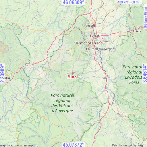
Murol GPS coordinates[2]
45° 34' 23.016" North, 2° 56' 34.836" East
| Map corner | latitude | longitude |
|---|---|---|
| Upper-left | 46.06309°, | 2.23989° |
| Center: | 45.57306°, | 2.94301° |
| Lower-right: | 45.07872°, | 3.64614° |
| Map W x H: | 109.5×109.5 km | = 68×68mi |
| max Lat: | 51.07786° ⇑73% North |
| Murol: | 45.57306° |
| min Lat: | ⇓27% South 41.3874° |
| min Long | Murol | max Long |
| -5.08615° | 2.94301° | 9.52242° |
| W 57%⇐ | ⇒43% E |
Elevation
Elevation of Murol is 844 m = 2769 ft, and this is 650.3 m = 2134 ft above average elevation for this country.
| Max E: |
2333 m = 7654 ft | 1.8% |
| Murol | 844 m 2769 ft | |
| Avg. | 193.7 m = 635 ft | |
Min E: |
-1 m = -3 ft | 98.2% |
See also: France elevation on elevation.city.
Geographical zone
Murol is located in North temperate zone (between Tropic of Cancer and the Arctic Circle). Distance of this North polar circle is 2333.9 km =1450.2 mi to North.| Distance of | km | miles | from Murol |
|---|---|---|---|
| North Pole | 4939.8 | 3069.4 | to North |
| Arctic Circle | 2333.9 | 1450.2 | to North |
| Tropic Cancer | 2461.3 | 1529.4 | to South |
| Equator | 5067.2 | 3148.6 | to South |


Nearby cities:
15 places around Murol: (largest is in red/bold)
• Aydat
10 km =6.2 mi,  13°
13°
• Besse-et-Saint-Anastaise
6.3 km =3.9 mi,  186°
186°
• Champeix
14.6 km =9.1 mi,  83°
83°
• La Bourboule
16 km =9.9 mi,  276°
276°
• Le Cheix
5.4 km =3.4 mi,  126°
126°
• Mont-Dore
10.4 km =6.5 mi,  272°
272°
• Montaigut-le-Blanc
11.5 km =7.1 mi, 82°
• Neschers
17.3 km =10.7 mi, 83°
• Nébouzat
16.1 km =10 mi,  349°
349°
• Plauzat
16.9 km =10.5 mi,  71°
71°
• Rochefort-Montagne
16.4 km =10.2 mi,  318°
318°
• Saint-Amant-Tallende
16.7 km =10.4 mi,  50°
50°
• Saint-Nectaire
4.2 km =2.6 mi, 66°
• Saint-Sandoux
14.9 km =9.3 mi,  59°
59°
• Saint-Saturnin
15.1 km =9.4 mi, 50°
Sources, notices
• [Note1] Compared only with cities in France existing in our database
• [Src1] Map data: © OpenStreetMap contributors (CC-BY-SA)
• [Src2] Other city data from geonames.org with taken over terms of usage.
• [Src3] Geographical zone / Annual Mean Temperature by Robert A. Rohde @ Wikipedia
