Aydat geodata
Aydat (Auvergne-Rhône-Alpes) is a populated place; located in France in Europe/Paris (GMT+2) time zone. With population of 1,714 people, there are 5482 cities with bigger population in this country. Compared to other cities in France, 71.6% of cities are located further ↑North; 57.4% of cities are located further ←West and 98.3% of cities have lower elevation than Aydat. Note1
Administrative division(s):
- Level 1: Auvergne-Rhône-Alpes
- Level 2: Département du Puy-de-Dôme
- Level 3: Arrondissement de Clermont-Ferrand
- Level 4: Aydat


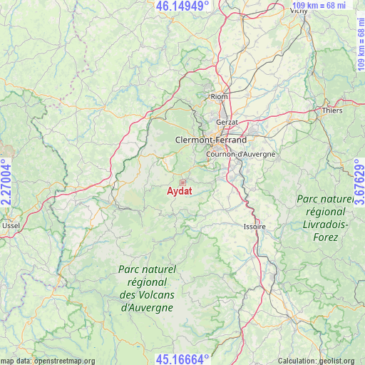
Aydat GPS coordinates[2]
45° 39' 36.792" North, 2° 58' 23.376" East
| Map corner | latitude | longitude |
|---|---|---|
| Upper-left | 46.14949°, | 2.27004° |
| Center: | 45.66022°, | 2.97316° |
| Lower-right: | 45.16664°, | 3.67629° |
| Map W x H: | 109.3×109.3 km | = 67.9×67.9mi |
| max Lat: | 51.07786° ⇑71.6% North |
| Aydat: | 45.66022° |
| min Lat: | ⇓28.4% South 41.3874° |
| min Long | Aydat | max Long |
| -5.08615° | 2.97316° | 9.52242° |
| W 57.4%⇐ | ⇒42.6% E |
Elevation
Elevation of Aydat is 860 m = 2822 ft, and this is 666.3 m = 2186 ft above average elevation for this country.
| Max E: |
2333 m = 7654 ft | 1.7% |
| Aydat | 860 m 2822 ft | |
| Avg. | 193.7 m = 635 ft | |
Min E: |
-1 m = -3 ft | 98.3% |
See also: France elevation on elevation.city.
Geographical zone
Aydat is located in North temperate zone (between Tropic of Cancer and the Arctic Circle). Distance of this North polar circle is 2324.2 km =1444.2 mi to North.| Distance of | km | miles | from Aydat |
|---|---|---|---|
| North Pole | 4930.1 | 3063.4 | to North |
| Arctic Circle | 2324.2 | 1444.2 | to North |
| Tropic Cancer | 2471 | 1535.4 | to South |
| Equator | 5076.9 | 3154.6 | to South |


Nearby cities:
15 places around Aydat: (largest is in red/bold)
• Ceyrat
10.7 km =6.6 mi,  40°
40°
• Chanonat
10 km =6.2 mi,  68°
68°
• La Roche-Blanche
12.7 km =7.9 mi, 69°
• Le Crest
12.3 km =7.6 mi,  76°
76°
• Montaigut-le-Blanc
12.3 km =7.6 mi,  132°
132°
• Murol
10 km =6.2 mi,  193°
193°
• Nébouzat
8.1 km =5 mi,  319°
319°
• Olby
12.5 km =7.8 mi, 319°
• Romagnat
12.5 km =7.8 mi,  52°
52°
• Saint-Amant-Tallende
10.5 km =6.5 mi, 84°
• Saint-Genès-Champanelle
7.6 km =4.7 mi,  27°
27°
• Saint-Nectaire
8.2 km =5.1 mi,  169°
169°
• Saint-Sandoux
10.7 km =6.6 mi,  101°
101°
• Saint-Saturnin
9.3 km =5.8 mi,  90°
90°
• Tallende
11.8 km =7.3 mi, 84°
Sources, notices
• [Note1] Compared only with cities in France existing in our database
• [Src1] Map data: © OpenStreetMap contributors (CC-BY-SA)
• [Src2] Other city data from geonames.org with taken over terms of usage.
• [Src3] Geographical zone / Annual Mean Temperature by Robert A. Rohde @ Wikipedia
