Besse-et-Saint-Anastaise geodata
Besse-et-Saint-Anastaise (Auvergne-Rhône-Alpes) is a populated place; located in France in Europe/Paris (GMT+2) time zone. With population of 1,636 people, there are 5709 cities with bigger population in this country. Compared to other cities in France, 73.9% of cities are located further ↑North; 56.8% of cities are located further ←West and 99.3% of cities have lower elevation than Besse-et-Saint-Anastaise. Note1
Administrative division(s):
- Level 1: Auvergne-Rhône-Alpes
- Level 2: Département du Puy-de-Dôme
- Level 3: Issoire
- Level 4: Besse-et-Saint-Anastaise
Current local time in Besse-et-Saint-Anastaise:
11:27 AM, SaturdayDifference from your time zone: hours


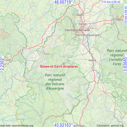
Besse-et-Saint-Anastaise GPS coordinates[2]
45° 31' 0.012" North, 2° 55' 59.988" East
| Map corner | latitude | longitude |
|---|---|---|
| Upper-left | 46.00719°, | 2.2302° |
| Center: | 45.51667°, | 2.93333° |
| Lower-right: | 45.02183°, | 3.63645° |
| Map W x H: | 109.6×109.6 km | = 68.1×68.1mi |
| max Lat: | 51.07786° ⇑73.9% North |
| Besse-et-Saint-Anastaise: | 45.51667° |
| min Lat: | ⇓26.1% South 41.3874° |
| min Long | Besse-et-Saint- | max Long |
| -5.08615° | 2.93333° | 9.52242° |
| W 56.8%⇐ | ⇒43.2% E |
Elevation
Elevation of Besse-et-Saint-Anastaise is 1042 m = 3419 ft, and this is 848.3 m = 2783 ft above average elevation for this country.
| Max E: |
2333 m = 7654 ft | 0.7% |
| Besse-et-Saint-Anastaise | 1042 m 3419 ft | |
| Avg. | 193.7 m = 635 ft | |
Min E: |
-1 m = -3 ft | 99.3% |
See also: France elevation on elevation.city.
Geographical zone
Besse-et-Saint-Anastaise is located in North temperate zone (between Tropic of Cancer and the Arctic Circle). Distance of this North polar circle is 2340.2 km =1454.1 mi to North.| Distance of | km | miles | from Besse-et-Saint-Anastaise |
|---|---|---|---|
| North Pole | 4946.1 | 3073.4 | to North |
| Arctic Circle | 2340.2 | 1454.1 | to North |
| Tropic Cancer | 2455.1 | 1525.5 | to South |
| Equator | 5061 | 3144.8 | to South |


Nearby cities:
15 places around Besse-et-Saint-Anastaise: (largest is in red/bold)
• Ardes
19.6 km =12.2 mi,  129°
129°
• Aydat
16.3 km =10.1 mi,  10°
10°
• Champeix
17.2 km =10.7 mi,  62°
62°
• La Bourboule
17.1 km =10.6 mi,  297°
297°
• La Tour-d’Auvergne
19.1 km =11.9 mi,  275°
275°
• Le Cheix
5.9 km =3.7 mi, 59°
• Mont-Dore
11.7 km =7.3 mi, 304°
• Montaigut-le-Blanc
14.4 km =8.9 mi, 57°
• Murol
6.3 km =3.9 mi, 6°
• Neschers
19.7 km =12.2 mi,  65°
65°
• Plauzat
20.4 km =12.7 mi, 55°
• Saint-Nectaire
9.2 km =5.7 mi,  30°
30°
• Saint-Sandoux
19.3 km =12 mi,  44°
44°
• Saint-Saturnin
20.1 km =12.5 mi, 37°
• Égliseneuve-d’Entraigues
14.6 km =9.1 mi,  214°
214°
Sources, notices
• [Note1] Compared only with cities in France existing in our database
• [Src1] Map data: © OpenStreetMap contributors (CC-BY-SA)
• [Src2] Other city data from geonames.org with taken over terms of usage.
• [Src3] Geographical zone / Annual Mean Temperature by Robert A. Rohde @ Wikipedia
