Steinsoultz geodata
Steinsoultz (Grand Est) is a populated place; located in France in Europe/Paris (GMT+2) time zone. With population of 654 people, there are 12467 cities with bigger population in this country. Compared to other cities in France, 52% of cities are located further ↓South; 96.8% of cities are located further ←West and 88.2% of cities have lower elevation than Steinsoultz. Note1
Administrative division(s):
- Level 1: Grand Est
- Level 2: Haut-Rhin
- Level 3: Altkirch
- Level 4: Steinsoultz


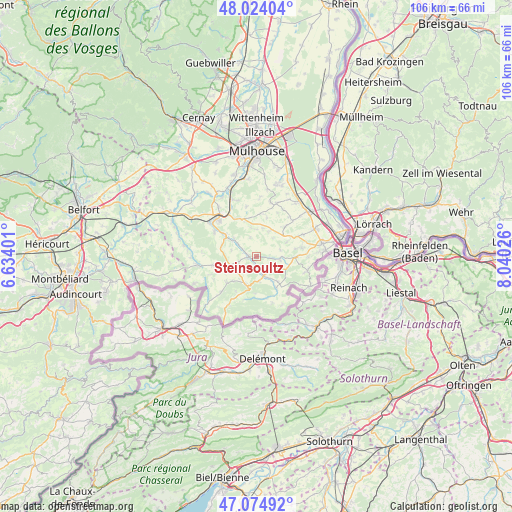
Steinsoultz GPS coordinates[2]
47° 33' 5.868" North, 7° 20' 13.668" East
| Map corner | latitude | longitude |
|---|---|---|
| Upper-left | 48.02404°, | 6.63401° |
| Center: | 47.55163°, | 7.33713° |
| Lower-right: | 47.07492°, | 8.04026° |
| Map W x H: | 105.5×105.5 km | = 65.6×65.6mi |
| max Lat: | 51.07786° ⇑48% North |
| Steinsoultz: | 47.55163° |
| min Lat: | ⇓52% South 41.3874° |
| min Long | Steinsoultz | max Long |
| -5.08615° | 7.33713° | 9.52242° |
| W 96.8%⇐ | ⇒3.2% E |
Elevation
Elevation of Steinsoultz is 391 m = 1283 ft, and this is 197.3 m = 647 ft above average elevation for this country.
| Max E: |
2333 m = 7654 ft | 11.8% |
| Steinsoultz | 391 m 1283 ft | |
| Avg. | 193.7 m = 635 ft | |
Min E: |
-1 m = -3 ft | 88.2% |
See also: France elevation on elevation.city.
Geographical zone
Steinsoultz is located in North temperate zone (between Tropic of Cancer and the Arctic Circle). Distance of this North polar circle is 2113.9 km =1313.5 mi to North.| Distance of | km | miles | from Steinsoultz |
|---|---|---|---|
| North Pole | 4719.8 | 2932.7 | to North |
| Arctic Circle | 2113.9 | 1313.5 | to North |
| Tropic Cancer | 2681.3 | 1666.1 | to South |
| Equator | 5287.2 | 3285.3 | to South |


Nearby cities:
15 places around Steinsoultz: (largest is in red/bold)
• Durmenach
2.6 km =1.6 mi,  176°
176°
• Ferrette
6.6 km =4.1 mi,  195°
195°
• Folgensbourg
8.2 km =5.1 mi,  91°
91°
• Grentzingen
3.2 km =2 mi,  296°
296°
• Heimersdorf
7.5 km =4.7 mi,  287°
287°
• Hirsingue
7.5 km =4.7 mi, 302°
• Jettingen
5.9 km =3.7 mi,  27°
27°
• Muespach-le-Haut
4.9 km =3 mi,  95°
95°
• Oberdorf
2.5 km =1.6 mi, 290°
• Oltingue
7.9 km =4.9 mi,  148°
148°
• Riespach
4 km =2.5 mi,  250°
250°
• Roppentzwiller
1.3 km =0.8 mi, 199°
• Vieux-Ferrette
6 km =3.7 mi,  206°
206°
• Waldighofen
1.7 km =1.1 mi,  265°
265°
• Werentzhouse
4 km =2.5 mi,  160°
160°
Sources, notices
• [Note1] Compared only with cities in France existing in our database
• [Src1] Map data: © OpenStreetMap contributors (CC-BY-SA)
• [Src2] Other city data from geonames.org with taken over terms of usage.
• [Src3] Geographical zone / Annual Mean Temperature by Robert A. Rohde @ Wikipedia
