Mousseaux-Neuville geodata
Mousseaux-Neuville (Normandy) is a populated place; located in France in Europe/Paris (GMT+2) time zone. With population of 659 people, there are 12396 cities with bigger population in this country. Compared to other cities in France, 77.7% of cities are located further ↓South; 65.1% of cities are located further →East and 51.7% of cities have lower elevation than Mousseaux-Neuville. Note1
Administrative division(s):
- Level 1: Normandy
- Level 2: Département de l'Eure
- Level 3: Arrondissement d’Évreux
- Level 4: Mousseaux-Neuville


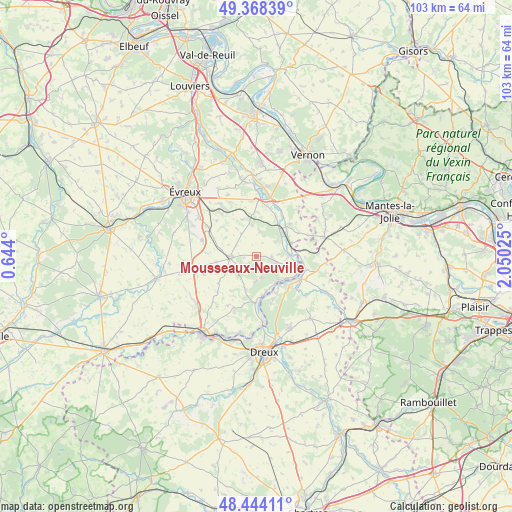
Mousseaux-Neuville GPS coordinates[2]
48° 54' 30.204" North, 1° 20' 49.632" East
| Map corner | latitude | longitude |
|---|---|---|
| Upper-left | 49.36839°, | 0.644° |
| Center: | 48.90839°, | 1.34712° |
| Lower-right: | 48.44411°, | 2.05025° |
| Map W x H: | 102.8×102.8 km | = 63.9×63.9mi |
| max Lat: | 51.07786° ⇑22.3% North |
| Mousseaux-Neuville: | 48.90839° |
| min Lat: | ⇓77.7% South 41.3874° |
| min Long | Mousseaux-Neuvi | max Long |
| -5.08615° | 1.34712° | 9.52242° |
| W 34.9%⇐ | ⇒65.1% E |
Elevation
Elevation of Mousseaux-Neuville is 138 m = 453 ft, and this is 55.7 m = 183 ft below average elevation for this country.
| Max E: |
2333 m = 7654 ft | 48.3% |
| Avg. | 193.7 m = 635 ft | |
| Mousseaux-Neuville | 138 m = 453 ft | |
Min E: |
-1 m = -3 ft | 51.7% |
See also: France elevation on elevation.city.
Geographical zone
Mousseaux-Neuville is located in North temperate zone (between Tropic of Cancer and the Arctic Circle). Distance of this North polar circle is 1963.1 km =1219.8 mi to North.| Distance of | km | miles | from Mousseaux-Neuville |
|---|---|---|---|
| North Pole | 4569 | 2839 | to North |
| Arctic Circle | 1963.1 | 1219.8 | to North |
| Tropic Cancer | 2832.2 | 1759.8 | to South |
| Equator | 5438.1 | 3379.1 | to South |


Nearby cities:
15 places around Mousseaux-Neuville: (largest is in red/bold)
• Anet
8.9 km =5.5 mi,  130°
130°
• Bois-le-Roi
5.1 km =3.2 mi,  183°
183°
• Breuilpont
8.6 km =5.3 mi,  44°
44°
• Bueil
7.4 km =4.6 mi,  69°
69°
• Croth
7.4 km =4.6 mi,  161°
161°
• Garencières
8 km =5 mi,  311°
311°
• Garennes-sur-Eure
6.7 km =4.2 mi,  87°
87°
• Ivry-la-Bataille
8.7 km =5.4 mi,  108°
108°
• La Couture-Boussey
4.4 km =2.7 mi, 108°
• Marcilly-sur-Eure
9.2 km =5.7 mi, 179°
• Mouettes
1.7 km =1.1 mi,  143°
143°
• Oulins
10.2 km =6.3 mi,  118°
118°
• Saussay
7.4 km =4.6 mi, 142°
• Sorel-Moussel
8.4 km =5.2 mi,  170°
170°
• Ézy-sur-Eure
6.9 km =4.3 mi, 132°
Sources, notices
• [Note1] Compared only with cities in France existing in our database
• [Src1] Map data: © OpenStreetMap contributors (CC-BY-SA)
• [Src2] Other city data from geonames.org with taken over terms of usage.
• [Src3] Geographical zone / Annual Mean Temperature by Robert A. Rohde @ Wikipedia
