Geyssans geodata
Geyssans (Auvergne-Rhône-Alpes) is a populated place; located in France in Europe/Paris (GMT+2) time zone. With population of 520 people, there are 14814 cities with bigger population in this country. Compared to other cities in France, 78.3% of cities are located further ↑North; 78.6% of cities are located further ←West and 81% of cities have lower elevation than Geyssans. Note1
Administrative division(s):
- Level 1: Auvergne-Rhône-Alpes
- Level 2: Département de la Drôme
- Level 3: Arrondissement de Valence
- Level 4: Geyssans


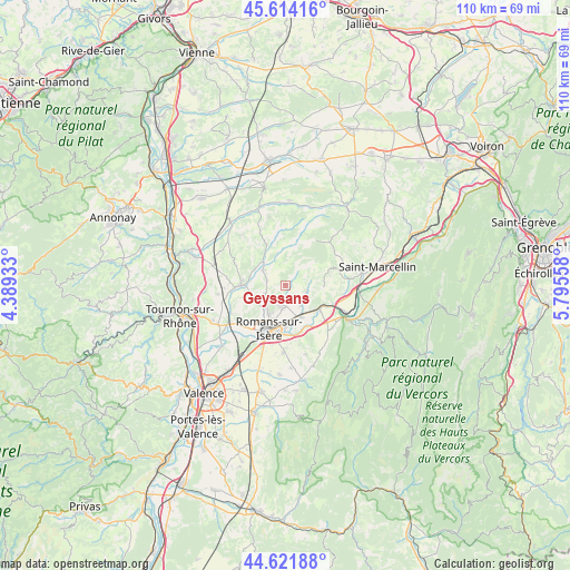
Geyssans GPS coordinates[2]
45° 7' 12.648" North, 5° 5' 32.856" East
| Map corner | latitude | longitude |
|---|---|---|
| Upper-left | 45.61416°, | 4.38933° |
| Center: | 45.12018°, | 5.09246° |
| Lower-right: | 44.62188°, | 5.79558° |
| Map W x H: | 110.3×110.3 km | = 68.5×68.5mi |
| max Lat: | 51.07786° ⇑78.3% North |
| Geyssans: | 45.12018° |
| min Lat: | ⇓21.7% South 41.3874° |
| min Long | Geyssans | max Long |
| -5.08615° | 5.09246° | 9.52242° |
| W 78.6%⇐ | ⇒21.4% E |
Elevation
Elevation of Geyssans is 300 m = 984 ft, and this is 106.3 m = 349 ft above average elevation for this country.
| Max E: |
2333 m = 7654 ft | 19% |
| Geyssans | 300 m 984 ft | |
| Avg. | 193.7 m = 635 ft | |
Min E: |
-1 m = -3 ft | 81% |
See also: France elevation on elevation.city.
Geographical zone
Geyssans is located in North temperate zone (between Tropic of Cancer and the Arctic Circle). Distance of this North polar circle is 2384.3 km =1481.5 mi to North.| Distance of | km | miles | from Geyssans |
|---|---|---|---|
| North Pole | 4990.2 | 3100.8 | to North |
| Arctic Circle | 2384.3 | 1481.5 | to North |
| Tropic Cancer | 2411 | 1498.1 | to South |
| Equator | 5016.9 | 3117.4 | to South |


Nearby cities:
15 places around Geyssans: (largest is in red/bold)
• Bourg-de-Péage
10.4 km =6.5 mi,  198°
198°
• Châtillon-Saint-Jean
4.7 km =2.9 mi,  141°
141°
• Crépol
6.4 km =4 mi,  345°
345°
• Eymeux
8.3 km =5.2 mi,  125°
125°
• Génissieux
4.1 km =2.5 mi,  192°
192°
• Margès
5.1 km =3.2 mi,  304°
304°
• Mours-Saint-Eusèbe
6.7 km =4.2 mi, 203°
• Parnans
4.1 km =2.5 mi,  106°
106°
• Peyrins
4.8 km =3 mi,  231°
231°
• Romans-sur-Isère
8.1 km =5 mi, 194°
• Saint-Antoine-l'Abbaye
11 km =6.8 mi,  62°
62°
• Saint-Bardoux
9.8 km =6.1 mi,  249°
249°
• Saint-Bonnet-de-Chavagne
10.9 km =6.8 mi,  86°
86°
• Saint-Lattier
9.4 km =5.8 mi, 112°
• Saint-Paul-lès-Romans
6.7 km =4.2 mi,  152°
152°
Sources, notices
• [Note1] Compared only with cities in France existing in our database
• [Src1] Map data: © OpenStreetMap contributors (CC-BY-SA)
• [Src2] Other city data from geonames.org with taken over terms of usage.
• [Src3] Geographical zone / Annual Mean Temperature by Robert A. Rohde @ Wikipedia
