Montredon-des-Corbières geodata
Montredon-des-Corbières (Occitanie) is a populated place; located in France in Europe/Paris (GMT+2) time zone. With population of 963 people, there are 9104 cities with bigger population in this country. Compared to other cities in France, 97.3% of cities are located further ↑North; 56.8% of cities are located further ←West and 88.3% of cities have higher elevation than Montredon-des-Corbières. Note1
Administrative division(s):
- Level 1: Occitanie
- Level 2: Département de l'Aude
- Level 3: Arrondissement de Narbonne
- Level 4: Montredon-des-Corbières
Current local time in Montredon-des-Corbières:
05:54 AM, WednesdayDifference from your time zone: hours


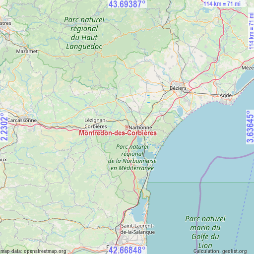
Montredon-des-Corbières GPS coordinates[2]
43° 10' 59.988" North, 2° 55' 59.988" East
| Map corner | latitude | longitude |
|---|---|---|
| Upper-left | 43.69387°, | 2.2302° |
| Center: | 43.18333°, | 2.93333° |
| Lower-right: | 42.66848°, | 3.63645° |
| Map W x H: | 114×114 km | = 70.8×70.8mi |
| max Lat: | 51.07786° ⇑97.3% North |
| Montredon-des-Corbières: | 43.18333° |
| min Lat: | ⇓2.7% South 41.3874° |
| min Long | Montredon-des-C | max Long |
| -5.08615° | 2.93333° | 9.52242° |
| W 56.8%⇐ | ⇒43.2% E |
Elevation
Elevation of Montredon-des-Corbières is 34 m = 112 ft, and this is 159.7 m = 524 ft below average elevation for this country.
| Max E: |
2333 m = 7654 ft | 88.3% |
| Avg. | 193.7 m = 635 ft | |
| Montredon-des-Corbières | 34 m = 112 ft | |
Min E: |
-1 m = -3 ft | 11.7% |
See also: France elevation on elevation.city.
Geographical zone
Montredon-des-Corbières is located in North temperate zone (between Tropic of Cancer and the Arctic Circle). Distance of this Northern Tropic circle is 2195.6 km =1364.3 mi to South.| Distance of | km | miles | from Montredon-des-Corbières |
|---|---|---|---|
| North Pole | 5205.5 | 3234.5 | to North |
| Arctic Circle | 2599.6 | 1615.3 | to North |
| Tropic Cancer | 2195.6 | 1364.3 | to South |
| Equator | 4801.5 | 2983.5 | to South |


Nearby cities:
15 places around Montredon-des-Corbières: (largest is in red/bold)
• Bages
8.2 km =5.1 mi,  145°
145°
• Bizanet
5.5 km =3.4 mi,  247°
247°
• Canet
8.5 km =5.3 mi,  305°
305°
• Coursan
11.5 km =7.1 mi,  60°
60°
• Ginestas
10.6 km =6.6 mi,  331°
331°
• Marcorignan
4.9 km =3 mi,  349°
349°
• Moussan
5.5 km =3.4 mi,  14°
14°
• Narbonne
5.5 km =3.4 mi,  89°
89°
• Névian
4.1 km =2.5 mi,  322°
322°
• Ornaisons
7.8 km =4.8 mi,  267°
267°
• Peyriac-de-Mer
10.9 km =6.8 mi,  169°
169°
• Saint-André-de-Roquelongue
10.9 km =6.8 mi,  226°
226°
• Saint-Marcel-sur-Aude
7.4 km =4.6 mi,  0°
0°
• Saint-Nazaire-d’Aude
7.6 km =4.7 mi,  335°
335°
• Ventenac-en-Minervois
9.2 km =5.7 mi, 323°
Sources, notices
• [Note1] Compared only with cities in France existing in our database
• [Src1] Map data: © OpenStreetMap contributors (CC-BY-SA)
• [Src2] Other city data from geonames.org with taken over terms of usage.
• [Src3] Geographical zone / Annual Mean Temperature by Robert A. Rohde @ Wikipedia
