Bizanet geodata
Bizanet (Occitanie) is a populated place; located in France in Europe/Paris (GMT+2) time zone. With population of 1,158 people, there are 7774 cities with bigger population in this country. Compared to other cities in France, 97.5% of cities are located further ↑North; 56% of cities are located further ←West and 78.6% of cities have higher elevation than Bizanet. Note1
Administrative division(s):
- Level 1: Occitanie
- Level 2: Département de l'Aude
- Level 3: Arrondissement de Narbonne
- Level 4: Bizanet


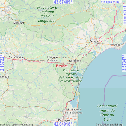
Bizanet GPS coordinates[2]
43° 9' 51.084" North, 2° 52' 13.224" East
| Map corner | latitude | longitude |
|---|---|---|
| Upper-left | 43.67489°, | 2.16722° |
| Center: | 43.16419°, | 2.87034° |
| Lower-right: | 42.64918°, | 3.57347° |
| Map W x H: | 114×114 km | = 70.8×70.8mi |
| max Lat: | 51.07786° ⇑97.5% North |
| Bizanet: | 43.16419° |
| min Lat: | ⇓2.5% South 41.3874° |
| min Long | Bizanet | max Long |
| -5.08615° | 2.87034° | 9.52242° |
| W 56%⇐ | ⇒44% E |
Elevation
Elevation of Bizanet is 58 m = 190 ft, and this is 135.7 m = 445 ft below average elevation for this country.
| Max E: |
2333 m = 7654 ft | 78.6% |
| Avg. | 193.7 m = 635 ft | |
| Bizanet | 58 m = 190 ft | |
Min E: |
-1 m = -3 ft | 21.4% |
See also: France elevation on elevation.city.
Geographical zone
Bizanet is located in North temperate zone (between Tropic of Cancer and the Arctic Circle). Distance of this Northern Tropic circle is 2193.5 km =1363 mi to South.| Distance of | km | miles | from Bizanet |
|---|---|---|---|
| North Pole | 5207.7 | 3235.9 | to North |
| Arctic Circle | 2601.8 | 1616.7 | to North |
| Tropic Cancer | 2193.5 | 1363 | to South |
| Equator | 4799.4 | 2982.2 | to South |


Nearby cities:
15 places around Bizanet: (largest is in red/bold)
• Bages
10.8 km =6.7 mi,  115°
115°
• Boutenac
6.7 km =4.2 mi,  254°
254°
• Canet
7.3 km =4.5 mi,  345°
345°
• Luc-sur-Orbieu
7.1 km =4.4 mi,  281°
281°
• Lézignan-Corbières
9.6 km =6 mi,  292°
292°
• Marcorignan
8.1 km =5 mi,  31°
31°
• Montredon-des-Corbières
5.5 km =3.4 mi,  67°
67°
• Moussan
9.8 km =6.1 mi,  41°
41°
• Narbonne
10.9 km =6.8 mi,  78°
78°
• Névian
6 km =3.7 mi, 26°
• Ornaisons
3.3 km =2.1 mi,  303°
303°
• Saint-André-de-Roquelongue
6.1 km =3.8 mi,  206°
206°
• Saint-Marcel-sur-Aude
10.8 km =6.7 mi, 28°
• Saint-Nazaire-d’Aude
9.2 km =5.7 mi,  12°
12°
• Ventenac-en-Minervois
9.5 km =5.9 mi,  358°
358°
Sources, notices
• [Note1] Compared only with cities in France existing in our database
• [Src1] Map data: © OpenStreetMap contributors (CC-BY-SA)
• [Src2] Other city data from geonames.org with taken over terms of usage.
• [Src3] Geographical zone / Annual Mean Temperature by Robert A. Rohde @ Wikipedia
