Montmain geodata
Montmain (Normandy) is a populated place; located in France in Europe/Paris (GMT+2) time zone. With population of 1,444 people, there are 6409 cities with bigger population in this country. Compared to other cities in France, 88.1% of cities are located further ↓South; 66.3% of cities are located further →East and 53.3% of cities have lower elevation than Montmain. Note1
Administrative division(s):
- Level 1: Normandy
- Level 2: Seine-Maritime
- Level 3: Arrondissement de Rouen
- Level 4: Montmain


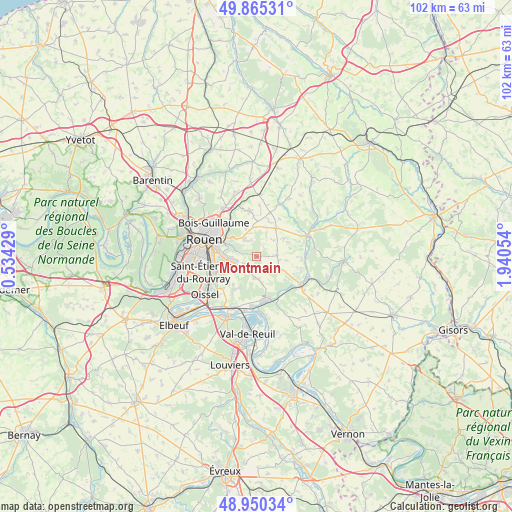
Montmain GPS coordinates[2]
49° 24' 35.856" North, 1° 14' 14.712" East
| Map corner | latitude | longitude |
|---|---|---|
| Upper-left | 49.86531°, | 0.53429° |
| Center: | 49.40996°, | 1.23742° |
| Lower-right: | 48.95034°, | 1.94054° |
| Map W x H: | 101.7×101.7 km | = 63.2×63.2mi |
| max Lat: | 51.07786° ⇑11.9% North |
| Montmain: | 49.40996° |
| min Lat: | ⇓88.1% South 41.3874° |
| min Long | Montmain | max Long |
| -5.08615° | 1.23742° | 9.52242° |
| W 33.7%⇐ | ⇒66.3% E |
Elevation
Elevation of Montmain is 144 m = 472 ft, and this is 49.7 m = 163 ft below average elevation for this country.
| Max E: |
2333 m = 7654 ft | 46.7% |
| Avg. | 193.7 m = 635 ft | |
| Montmain | 144 m = 472 ft | |
Min E: |
-1 m = -3 ft | 53.3% |
See also: France elevation on elevation.city.
Geographical zone
Montmain is located in North temperate zone (between Tropic of Cancer and the Arctic Circle). Distance of this North polar circle is 1907.3 km =1185.1 mi to North.| Distance of | km | miles | from Montmain |
|---|---|---|---|
| North Pole | 4513.2 | 2804.4 | to North |
| Arctic Circle | 1907.3 | 1185.1 | to North |
| Tropic Cancer | 2888 | 1794.5 | to South |
| Equator | 5493.9 | 3413.8 | to South |


Nearby cities:
15 places around Montmain: (largest is in red/bold)
• Amfreville-la-Mi-Voie
7.1 km =4.4 mi,  267°
267°
• Auzouville-sur-Ry
6.4 km =4 mi,  56°
56°
• Belbeuf
7.3 km =4.5 mi,  250°
250°
• Boos
3.4 km =2.1 mi,  225°
225°
• Bourg-Beaudouin
5.8 km =3.6 mi,  116°
116°
• Darnétal
7.4 km =4.6 mi,  302°
302°
• Fresne-le-Plan
4.2 km =2.6 mi,  86°
86°
• Le Mesnil-Esnard
6.7 km =4.2 mi, 273°
• Martainville-Épreville
6.9 km =4.3 mi,  35°
35°
• Mesnil-Raoul
3.1 km =1.9 mi, 118°
• Quévreville-la-Poterie
7 km =4.3 mi,  209°
209°
• Roncherolles-sur-le-Vivier
7.4 km =4.6 mi,  328°
328°
• Saint-Aubin-Épinay
5.2 km =3.2 mi,  278°
278°
• Saint-Jacques-sur-Darnétal
4.1 km =2.5 mi,  323°
323°
• Saint-Léger-du-Bourg-Denis
6.3 km =3.9 mi,  294°
294°
Sources, notices
• [Note1] Compared only with cities in France existing in our database
• [Src1] Map data: © OpenStreetMap contributors (CC-BY-SA)
• [Src2] Other city data from geonames.org with taken over terms of usage.
• [Src3] Geographical zone / Annual Mean Temperature by Robert A. Rohde @ Wikipedia
