Boos geodata
Boos (Normandy) is a populated place; located in France in Europe/Paris (GMT+2) time zone. With population of 3,028 people, there are 3220 cities with bigger population in this country. Compared to other cities in France, 87.7% of cities are located further ↓South; 66.7% of cities are located further →East and 56.6% of cities have lower elevation than Boos. Note1
Administrative division(s):
- Level 1: Normandy
- Level 2: Seine-Maritime
- Level 3: Arrondissement de Rouen
- Level 4: Boos


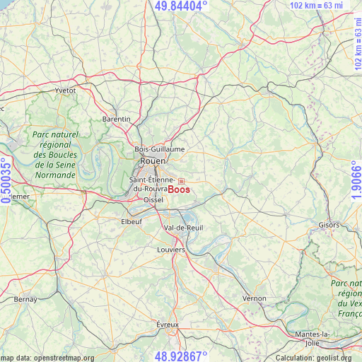
Boos GPS coordinates[2]
49° 23' 18.564" North, 1° 12' 12.528" East
| Map corner | latitude | longitude |
|---|---|---|
| Upper-left | 49.84404°, | 0.50035° |
| Center: | 49.38849°, | 1.20348° |
| Lower-right: | 48.92867°, | 1.9066° |
| Map W x H: | 101.8×101.8 km | = 63.3×63.3mi |
| max Lat: | 51.07786° ⇑12.3% North |
| Boos: | 49.38849° |
| min Lat: | ⇓87.7% South 41.3874° |
| min Long | Boos | max Long |
| -5.08615° | 1.20348° | 9.52242° |
| W 33.3%⇐ | ⇒66.7% E |
Elevation
Elevation of Boos is 156 m = 512 ft, and this is 37.7 m = 124 ft below average elevation for this country.
| Max E: |
2333 m = 7654 ft | 43.4% |
| Avg. | 193.7 m = 635 ft | |
| Boos | 156 m = 512 ft | |
Min E: |
-1 m = -3 ft | 56.6% |
See also: France elevation on elevation.city.
Geographical zone
Boos is located in North temperate zone (between Tropic of Cancer and the Arctic Circle). Distance of this North polar circle is 1909.7 km =1186.6 mi to North.| Distance of | km | miles | from Boos |
|---|---|---|---|
| North Pole | 4515.6 | 2805.9 | to North |
| Arctic Circle | 1909.7 | 1186.6 | to North |
| Tropic Cancer | 2885.6 | 1793 | to South |
| Equator | 5491.5 | 3412.3 | to South |


Nearby cities:
15 places around Boos: (largest is in red/bold)
• Amfreville-la-Mi-Voie
5.1 km =3.2 mi,  294°
294°
• Belbeuf
4.4 km =2.7 mi,  268°
268°
• Fresne-le-Plan
7.1 km =4.4 mi,  68°
68°
• Gouy
5.5 km =3.4 mi,  225°
225°
• Le Mesnil-Esnard
5 km =3.1 mi,  303°
303°
• Les Authieux-sur-le-Port-Saint-Ouen
7.3 km =4.5 mi,  223°
223°
• Mesnil-Raoul
5.2 km =3.2 mi,  80°
80°
• Montmain
3.4 km =2.1 mi,  45°
45°
• Quévreville-la-Poterie
3.8 km =2.4 mi,  194°
194°
• Saint-Aubin-Celloville
4.2 km =2.6 mi, 228°
• Saint-Aubin-Épinay
4.1 km =2.5 mi,  319°
319°
• Saint-Jacques-sur-Darnétal
5.7 km =3.5 mi,  0°
0°
• Saint-Léger-du-Bourg-Denis
6 km =3.7 mi,  326°
326°
• Saint-Étienne-du-Rouvray
7.2 km =4.5 mi,  260°
260°
• Ymare
4.6 km =2.9 mi,  202°
202°
Sources, notices
• [Note1] Compared only with cities in France existing in our database
• [Src1] Map data: © OpenStreetMap contributors (CC-BY-SA)
• [Src2] Other city data from geonames.org with taken over terms of usage.
• [Src3] Geographical zone / Annual Mean Temperature by Robert A. Rohde @ Wikipedia
