Saint-Aubin-Épinay geodata
Saint-Aubin-Épinay (Normandy) is a populated place; located in France in Europe/Paris (GMT+2) time zone. With population of 989 people, there are 8914 cities with bigger population in this country. Compared to other cities in France, 88.2% of cities are located further ↓South; 67.2% of cities are located further →East and 52.8% of cities have lower elevation than Saint-Aubin-Épinay. Note1
Administrative division(s):
- Level 1: Normandy
- Level 2: Seine-Maritime
- Level 3: Arrondissement de Rouen
- Level 4: Saint-Aubin-Épinay


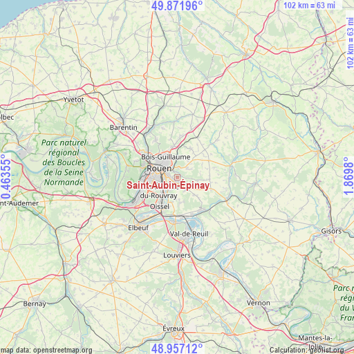
Saint-Aubin-Épinay GPS coordinates[2]
49° 25' 0.012" North, 1° 10' 0.012" East
| Map corner | latitude | longitude |
|---|---|---|
| Upper-left | 49.87196°, | 0.46355° |
| Center: | 49.41667°, | 1.16667° |
| Lower-right: | 48.95712°, | 1.8698° |
| Map W x H: | 101.7×101.7 km | = 63.2×63.2mi |
| max Lat: | 51.07786° ⇑11.8% North |
| Saint-Aubin-Épinay: | 49.41667° |
| min Lat: | ⇓88.2% South 41.3874° |
| min Long | Saint-Aubin-Ép | max Long |
| -5.08615° | 1.16667° | 9.52242° |
| W 32.8%⇐ | ⇒67.2% E |
Elevation
Elevation of Saint-Aubin-Épinay is 142 m = 466 ft, and this is 51.7 m = 170 ft below average elevation for this country.
| Max E: |
2333 m = 7654 ft | 47.2% |
| Avg. | 193.7 m = 635 ft | |
| Saint-Aubin-Épinay | 142 m = 466 ft | |
Min E: |
-1 m = -3 ft | 52.8% |
See also: France elevation on elevation.city.
Geographical zone
Saint-Aubin-Épinay is located in North temperate zone (between Tropic of Cancer and the Arctic Circle). Distance of this North polar circle is 1906.6 km =1184.7 mi to North.| Distance of | km | miles | from Saint-Aubin-Épinay |
|---|---|---|---|
| North Pole | 4512.4 | 2803.9 | to North |
| Arctic Circle | 1906.6 | 1184.7 | to North |
| Tropic Cancer | 2888.7 | 1795 | to South |
| Equator | 5494.6 | 3414.2 | to South |


Nearby cities:
15 places around Saint-Aubin-Épinay: (largest is in red/bold)
• Amfreville-la-Mi-Voie
2.3 km =1.4 mi,  243°
243°
• Belbeuf
3.7 km =2.3 mi,  208°
208°
• Bihorel
5.3 km =3.3 mi,  322°
322°
• Bois-Guillaume
5.8 km =3.6 mi,  326°
326°
• Boos
4.1 km =2.5 mi,  139°
139°
• Darnétal
3.4 km =2.1 mi,  340°
340°
• Le Mesnil-Esnard
1.6 km =1 mi,  256°
256°
• Montmain
5.2 km =3.2 mi,  98°
98°
• Roncherolles-sur-le-Vivier
5.7 km =3.5 mi,  12°
12°
• Rouen
5.7 km =3.5 mi,  301°
301°
• Saint-Aubin-Celloville
5.9 km =3.7 mi,  184°
184°
• Saint-Jacques-sur-Darnétal
3.7 km =2.3 mi,  46°
46°
• Saint-Léger-du-Bourg-Denis
2 km =1.2 mi, 341°
• Saint-Martin-du-Vivier
5.6 km =3.5 mi,  0°
0°
• Sotteville-lès-Rouen
5.6 km =3.5 mi, 262°
Sources, notices
• [Note1] Compared only with cities in France existing in our database
• [Src1] Map data: © OpenStreetMap contributors (CC-BY-SA)
• [Src2] Other city data from geonames.org with taken over terms of usage.
• [Src3] Geographical zone / Annual Mean Temperature by Robert A. Rohde @ Wikipedia
