Saint-Denis-de-Gastines geodata
Saint-Denis-de-Gastines (Pays de la Loire) is a populated place; located in France in Europe/Paris (GMT+2) time zone. With population of 1,764 people, there are 5367 cities with bigger population in this country. Compared to other cities in France, 65.3% of cities are located further ↓South; 86.9% of cities are located further →East and 72% of cities have lower elevation than Saint-Denis-de-Gastines. Note1
Administrative division(s):
- Level 1: Pays de la Loire
- Level 2: Mayenne
- Level 3: Arrondissement de Mayenne
- Level 4: Saint-Denis-de-Gastines
Current local time in Saint-Denis-de-Gastines:
05:58 AM, WednesdayDifference from your time zone: hours


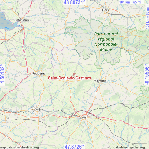
Saint-Denis-de-Gastines GPS coordinates[2]
48° 20' 31.56" North, 0° 51' 31.284" West
| Map corner | latitude | longitude |
|---|---|---|
| Upper-left | 48.80731°, | -1.56182° |
| Center: | 48.3421°, | -0.85869° |
| Lower-right: | 47.8726°, | -0.15556° |
| Map W x H: | 103.9×103.9 km | = 64.6×64.6mi |
| max Lat: | 51.07786° ⇑34.7% North |
| Saint-Denis-de-Gastines: | 48.3421° |
| min Lat: | ⇓65.3% South 41.3874° |
| min Long | Saint-Denis-de- | max Long |
| -5.08615° | -0.85869° | 9.52242° |
| W 13.1%⇐ | ⇒86.9% E |
Elevation
Elevation of Saint-Denis-de-Gastines is 230 m = 755 ft, and this is 36.3 m = 119 ft above average elevation for this country.
| Max E: |
2333 m = 7654 ft | 28% |
| Saint-Denis-de-Gastines | 230 m 755 ft | |
| Avg. | 193.7 m = 635 ft | |
Min E: |
-1 m = -3 ft | 72% |
See also: France elevation on elevation.city.
Geographical zone
Saint-Denis-de-Gastines is located in North temperate zone (between Tropic of Cancer and the Arctic Circle). Distance of this North polar circle is 2026 km =1258.9 mi to North.| Distance of | km | miles | from Saint-Denis-de-Gastines |
|---|---|---|---|
| North Pole | 4631.9 | 2878.1 | to North |
| Arctic Circle | 2026 | 1258.9 | to North |
| Tropic Cancer | 2769.2 | 1720.7 | to South |
| Equator | 5375.1 | 3339.9 | to South |


Nearby cities:
15 places around Saint-Denis-de-Gastines: (largest is in red/bold)
• Brecé
7.8 km =4.8 mi,  33°
33°
• Chailland
13.1 km =8.1 mi,  184°
184°
• Châtillon-sur-Colmont
8.5 km =5.3 mi,  93°
93°
• Colombiers-du-Plessis
5.7 km =3.5 mi,  14°
14°
• Désertines
14.1 km =8.8 mi,  357°
357°
• Ernée
7.3 km =4.5 mi,  227°
227°
• Gorron
8.4 km =5.2 mi,  23°
23°
• Larchamp
10.6 km =6.6 mi,  281°
281°
• Montaudin
10.8 km =6.7 mi,  296°
296°
• Montenay
6.6 km =4.1 mi,  203°
203°
• Oisseau
13.9 km =8.6 mi,  83°
83°
• Saint-Georges-Buttavent
12.7 km =7.9 mi,  106°
106°
• Saint-Hilaire-du-Maine
13.9 km =8.6 mi, 202°
• Saint-Pierre-des-Landes
14.6 km =9.1 mi,  238°
238°
• Vautorte
5 km =3.1 mi,  158°
158°
Sources, notices
• [Note1] Compared only with cities in France existing in our database
• [Src1] Map data: © OpenStreetMap contributors (CC-BY-SA)
• [Src2] Other city data from geonames.org with taken over terms of usage.
• [Src3] Geographical zone / Annual Mean Temperature by Robert A. Rohde @ Wikipedia
