Ernée geodata
Ernée (Pays de la Loire) is a populated place; located in France in Europe/Paris (GMT+2) time zone. With population of 6,127 people, there are 1615 cities with bigger population in this country. Compared to other cities in France, 64.5% of cities are located further ↓South; 87.6% of cities are located further →East and 52.8% of cities have lower elevation than Ernée. Note1
Administrative division(s):
- Level 1: Pays de la Loire
- Level 2: Mayenne
- Level 3: Arrondissement de Mayenne
- Level 4: Ernée


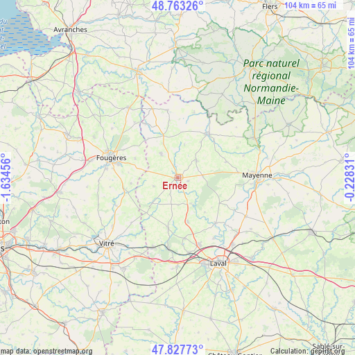
Ernée GPS coordinates[2]
48° 17' 51.504" North, 0° 55' 53.148" West
| Map corner | latitude | longitude |
|---|---|---|
| Upper-left | 48.76326°, | -1.63456° |
| Center: | 48.29764°, | -0.93143° |
| Lower-right: | 47.82773°, | -0.22831° |
| Map W x H: | 104×104 km | = 64.6×64.6mi |
| max Lat: | 51.07786° ⇑35.5% North |
| Ernée: | 48.29764° |
| min Lat: | ⇓64.5% South 41.3874° |
| min Long | Ernée | max Long |
| -5.08615° | -0.93143° | 9.52242° |
| W 12.4%⇐ | ⇒87.6% E |
Elevation
Elevation of Ernée is 142 m = 466 ft, and this is 51.7 m = 170 ft below average elevation for this country.
| Max E: |
2333 m = 7654 ft | 47.2% |
| Avg. | 193.7 m = 635 ft | |
| Ernée | 142 m = 466 ft | |
Min E: |
-1 m = -3 ft | 52.8% |
See also: France elevation on elevation.city.
Geographical zone
Ernée is located in North temperate zone (between Tropic of Cancer and the Arctic Circle). Distance of this North polar circle is 2031 km =1262 mi to North.| Distance of | km | miles | from Ernée |
|---|---|---|---|
| North Pole | 4636.9 | 2881.2 | to North |
| Arctic Circle | 2031 | 1262 | to North |
| Tropic Cancer | 2764.3 | 1717.7 | to South |
| Equator | 5370.2 | 3336.9 | to South |


Nearby cities:
15 places around Ernée: (largest is in red/bold)
• Chailland
9.1 km =5.7 mi,  152°
152°
• Châtillon-sur-Colmont
14.6 km =9.1 mi,  72°
72°
• Colombiers-du-Plessis
12.4 km =7.7 mi,  32°
32°
• Juvigné
10.8 km =6.7 mi,  224°
224°
• La Baconnière
13.4 km =8.3 mi,  167°
167°
• La Chapelle-Janson
13.8 km =8.6 mi,  293°
293°
• La Croixille
13.9 km =8.6 mi, 222°
• Larchamp
8.7 km =5.4 mi,  324°
324°
• Luitré
14 km =8.7 mi,  263°
263°
• Montaudin
10.7 km =6.6 mi,  336°
336°
• Montenay
3 km =1.9 mi,  111°
111°
• Saint-Denis-de-Gastines
7.3 km =4.5 mi,  47°
47°
• Saint-Hilaire-du-Maine
7.9 km =4.9 mi,  179°
179°
• Saint-Pierre-des-Landes
7.6 km =4.7 mi,  249°
249°
• Vautorte
7.3 km =4.5 mi,  87°
87°
Sources, notices
• [Note1] Compared only with cities in France existing in our database
• [Src1] Map data: © OpenStreetMap contributors (CC-BY-SA)
• [Src2] Other city data from geonames.org with taken over terms of usage.
• [Src3] Geographical zone / Annual Mean Temperature by Robert A. Rohde @ Wikipedia
