Montagrier geodata
Montagrier (Nouvelle-Aquitaine) is a populated place; located in France in Europe/Paris (GMT+2) time zone. With population of 519 people, there are 14840 cities with bigger population in this country. Compared to other cities in France, 76.7% of cities are located further ↑North; 73.6% of cities are located further →East and 54.2% of cities have lower elevation than Montagrier. Note1
Administrative division(s):
- Level 1: Nouvelle-Aquitaine
- Level 2: Dordogne
- Level 3: Arrondissement de Périgueux
- Level 4: Montagrier


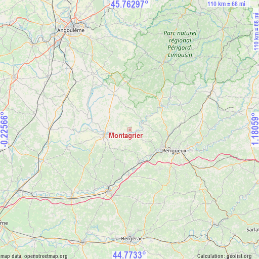
Montagrier GPS coordinates[2]
45° 16' 13.044" North, 0° 28' 38.856" East
| Map corner | latitude | longitude |
|---|---|---|
| Upper-left | 45.76297°, | -0.22566° |
| Center: | 45.27029°, | 0.47746° |
| Lower-right: | 44.7733°, | 1.18059° |
| Map W x H: | 110×110 km | = 68.4×68.4mi |
| max Lat: | 51.07786° ⇑76.7% North |
| Montagrier: | 45.27029° |
| min Lat: | ⇓23.3% South 41.3874° |
| min Long | Montagrier | max Long |
| -5.08615° | 0.47746° | 9.52242° |
| W 26.4%⇐ | ⇒73.6% E |
Elevation
Elevation of Montagrier is 147 m = 482 ft, and this is 46.7 m = 153 ft below average elevation for this country.
| Max E: |
2333 m = 7654 ft | 45.8% |
| Avg. | 193.7 m = 635 ft | |
| Montagrier | 147 m = 482 ft | |
Min E: |
-1 m = -3 ft | 54.2% |
See also: France elevation on elevation.city.
Geographical zone
Montagrier is located in North temperate zone (between Tropic of Cancer and the Arctic Circle). Distance of this North polar circle is 2367.6 km =1471.2 mi to North.| Distance of | km | miles | from Montagrier |
|---|---|---|---|
| North Pole | 4973.5 | 3090.4 | to North |
| Arctic Circle | 2367.6 | 1471.2 | to North |
| Tropic Cancer | 2427.7 | 1508.5 | to South |
| Equator | 5033.6 | 3127.7 | to South |


Nearby cities:
15 places around Montagrier: (largest is in red/bold)
• Allemans
14 km =8.7 mi,  275°
275°
• Annesse-et-Beaulieu
13.9 km =8.6 mi,  147°
147°
• Bourdeilles
10.3 km =6.4 mi,  56°
56°
• Celles
5.9 km =3.7 mi,  300°
300°
• Grand-Brassac
1.5 km =0.9 mi,  17°
17°
• La Chapelle-Gonaguet
11.3 km =7 mi,  112°
112°
• Lisle
5.8 km =3.6 mi,  80°
80°
• Mensignac
8.3 km =5.2 mi,  127°
127°
• Ribérac
11.5 km =7.1 mi,  258°
258°
• Saint-Astier
14.4 km =8.9 mi,  163°
163°
• Saint-Martin-de-Ribérac
10.8 km =6.7 mi,  247°
247°
• Saint-Vincent-de-Connezac
13.4 km =8.3 mi,  207°
207°
• Tocane-Saint-Apre
2.4 km =1.5 mi,  140°
140°
• Verteillac
12.2 km =7.6 mi,  314°
314°
• Villetoureix
9 km =5.6 mi, 264°
Sources, notices
• [Note1] Compared only with cities in France existing in our database
• [Src1] Map data: © OpenStreetMap contributors (CC-BY-SA)
• [Src2] Other city data from geonames.org with taken over terms of usage.
• [Src3] Geographical zone / Annual Mean Temperature by Robert A. Rohde @ Wikipedia
