Monoblet geodata
Monoblet (Occitanie) is a populated place; located in France in Europe/Paris (GMT+2) time zone. With population of 633 people, there are 12771 cities with bigger population in this country. Compared to other cities in France, 87.1% of cities are located further ↑North; 66.8% of cities are located further ←West and 82.1% of cities have lower elevation than Monoblet. Note1
Administrative division(s):
- Level 1: Occitanie
- Level 2: Gard
- Level 3: Arrondissement du Vigan
- Level 4: Monoblet


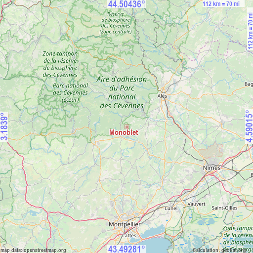
Monoblet GPS coordinates[2]
44° 0' 2.664" North, 3° 53' 13.272" East
| Map corner | latitude | longitude |
|---|---|---|
| Upper-left | 44.50436°, | 3.1839° |
| Center: | 44.00074°, | 3.88702° |
| Lower-right: | 43.49281°, | 4.59015° |
| Map W x H: | 112.5×112.5 km | = 69.9×69.9mi |
| max Lat: | 51.07786° ⇑87.1% North |
| Monoblet: | 44.00074° |
| min Lat: | ⇓12.9% South 41.3874° |
| min Long | Monoblet | max Long |
| -5.08615° | 3.88702° | 9.52242° |
| W 66.8%⇐ | ⇒33.2% E |
Elevation
Elevation of Monoblet is 311 m = 1020 ft, and this is 117.3 m = 385 ft above average elevation for this country.
| Max E: |
2333 m = 7654 ft | 17.9% |
| Monoblet | 311 m 1020 ft | |
| Avg. | 193.7 m = 635 ft | |
Min E: |
-1 m = -3 ft | 82.1% |
See also: France elevation on elevation.city.
Geographical zone
Monoblet is located in North temperate zone (between Tropic of Cancer and the Arctic Circle). Distance of this Northern Tropic circle is 2286.5 km =1420.8 mi to South.| Distance of | km | miles | from Monoblet |
|---|---|---|---|
| North Pole | 5114.6 | 3178.1 | to North |
| Arctic Circle | 2508.8 | 1558.9 | to North |
| Tropic Cancer | 2286.5 | 1420.8 | to South |
| Equator | 4892.4 | 3040 | to South |


Nearby cities:
15 places around Monoblet: (largest is in red/bold)
• Anduze
9.9 km =6.2 mi,  52°
52°
• Boisset-et-Gaujac
11 km =6.8 mi,  61°
61°
• Durfort-et-Saint-Martin-de-Sossenac
5.6 km =3.5 mi,  102°
102°
• Générargues
11.9 km =7.4 mi,  40°
40°
• Lasalle
5.6 km =3.5 mi,  332°
332°
• Lézan
13.2 km =8.2 mi,  82°
82°
• Massillargues-Attuech
11.1 km =6.9 mi, 81°
• Mialet
13.1 km =8.1 mi,  20°
20°
• Pompignan
12.2 km =7.6 mi,  191°
191°
• Quissac
13.2 km =8.2 mi,  137°
137°
• Saint-Hippolyte-du-Fort
4.8 km =3 mi,  211°
211°
• Saint-Jean-du-Gard
11.6 km =7.2 mi,  359°
359°
• Sauve
8.2 km =5.1 mi, 143°
• Sumène
13.9 km =8.6 mi,  260°
260°
• Tornac
9 km =5.6 mi, 75°
Sources, notices
• [Note1] Compared only with cities in France existing in our database
• [Src1] Map data: © OpenStreetMap contributors (CC-BY-SA)
• [Src2] Other city data from geonames.org with taken over terms of usage.
• [Src3] Geographical zone / Annual Mean Temperature by Robert A. Rohde @ Wikipedia
